Login

Forgot your login?

Cookies have to be accepted!
Your browser's cookie functionality is disabled. Please enable this functionality.

Not a member yet?

Register now
Login

Available for registred users only

Log in to use this feature.

Forgot your login?

Cookies have to be accepted!
Your browser's cookie functionality is disabled. Please enable this functionality.

Not a member yet?

Register now
Filter
Categories
Advanced filters
  • Distance (km)
  • Height
Save filters Reset filter

TrackRank

QRCode

Technical data

Distance3,3 km Height92 m Way down41 m Duration00:00 h:m Date04.05.2022
Scores Author Landscape Fun factor Fitness Technique

Statistics

71 Views Scores 14 Downloads Average
Rate
  • Track data sheet
  • Directions
  • Downloads
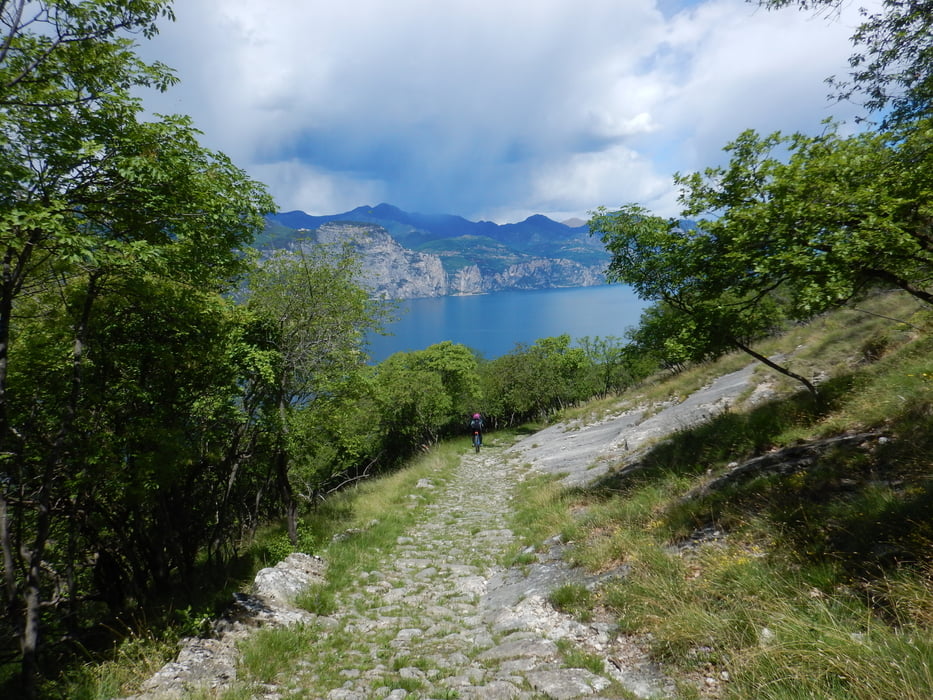
Versione più corta del Trail Campo, si evitano ulteriori 300mt di dislivello e poi ci si collega al percorso di origine. Rientro suggestivo dove sono numerosi i punti panoramici per vedere il lago da un altro punto di vista.

Tour gallery

Tour map and elevation profile

  • Open Street Map
  • Google
Minimum height 627 m Maximum height 700 m Detailed view

More about the tour author

Dolomeet
Member since 2018

Send private message

Comments

GPS tracks

Trackpoints
  • GPX / Garmin Map Source (gpx) download
  • TCX / Garmin Training Center® (tcx) download
  • CRS / Garmin Training Center® (crs) download
  • Google Earth (kml) download
  • G7ToWin (g7t) download
  • TTQV (trk) download
  • Overlay (ovl) download
  • Fugawi (txt) download
  • Kompass (DAV) Track (tk) download
  • Track data sheet (pdf) download
  • Original file of the author (gpx) download

More about the tour author

Dolomeet
Member since 2018

Send private message
Share track
Add to my favorites
Remove from my favorites
Edit tags
My score
Rate
Track: Trail Campo Short
Type: Mountain bike
Distance: 3,3 km
Evaluated on:
Duration:
Day(s)
Hour(s)
Minute(s)
Score: Landscape Fun factor Fitness Technique