
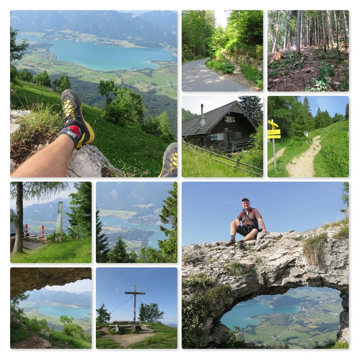

Der Wanderweg beginnt an der Mautstraße und fürht den Berg steil nach oben. Mehrmals wird eine Forststraße gekreuzt, dann erreicht man die Bleckwand Hütte.
Der Wanderweg führt an der Bleckwand Hütte vorbei und steigt linkerhand weiter an. Im oberen Teil könnte man auch über die Forststraße gehen. Doch meine Route bleibt am direkten Weg.
Zuerst erreicht man das Bleckwand Loch "Fenster zum See", etwas dahinter dann das Gipfelkreuz.
Tipp: Bleckwandhütte (naturfreunde.at)
Further information at
https://bleckwandhuette.naturfreunde.at/Tour map and elevation profile
Minimum height 933 m
Maximum height 1515 m
Comments

Gschwendt, Mautstraße. Nähe Wanderweg, an den Koordinaten N47° 42' 16.3" E13° 25' 42.4" ist genug Platz zum Parken (bei Bankerl).
Weitere Parkmöglichkeiten gibt es am Beginn der Mautstraße oder am Berg.
GPS tracks
Trackpoints-
GPX / Garmin Map Source (gpx) download
-
TCX / Garmin Training Center® (tcx) download
-
CRS / Garmin Training Center® (crs) download
-
Google Earth (kml) download
-
G7ToWin (g7t) download
-
TTQV (trk) download
-
Overlay (ovl) download
-
Fugawi (txt) download
-
Kompass (DAV) Track (tk) download
-
Track data sheet (pdf) download
-
Original file of the author (gpx) download
Add to my favorites
Remove from my favorites
Edit tags
Open track
My score
Rate