


Von Hintermoos über Bachwinkel hinauf zum Langeck und zum Hundstein.
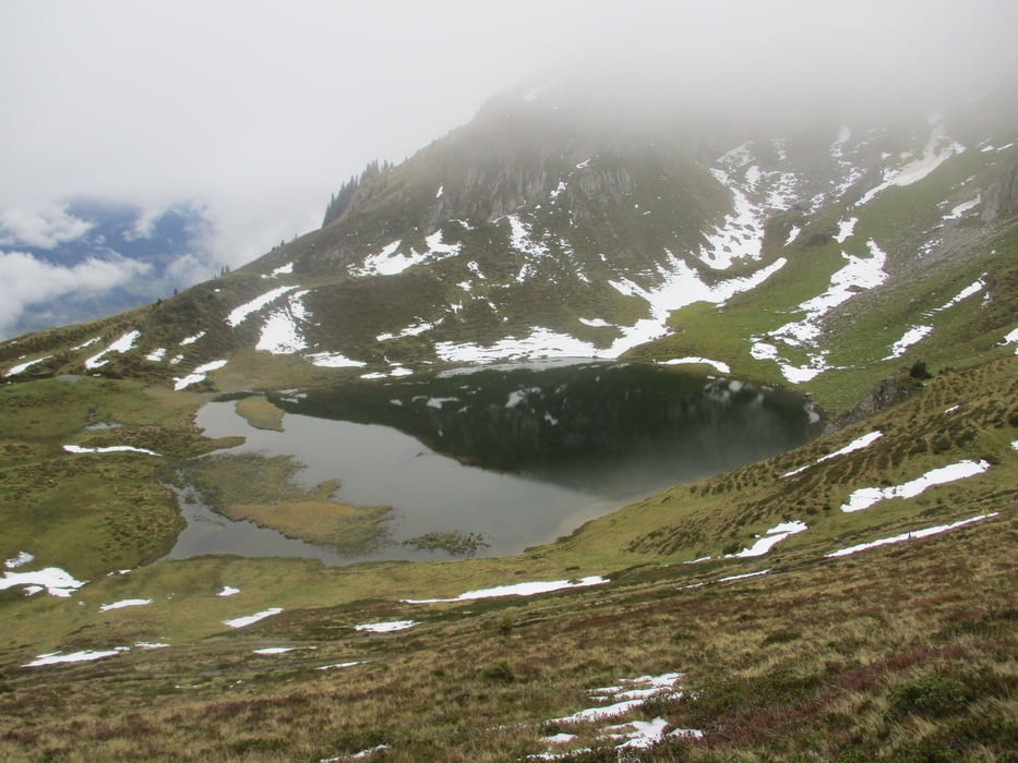
Kurz vorher links ab zum Hundsteiner See und weiter den Kamm entlang auf den Hochkasern.
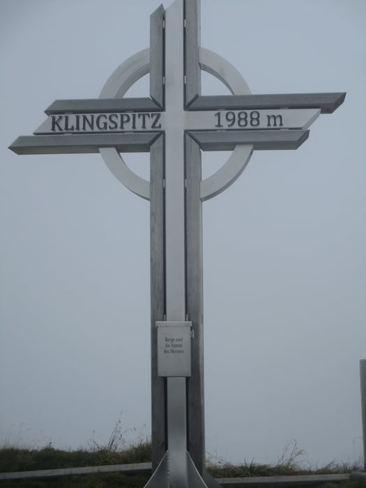
Hinüber zum Klingspitz und hinab zur Marbachhöhe.
Hier links steil hinunter zu den Geralmen und zur Eggeralm.
Kurz darauf ist der Ausgangspunkt erreicht.
Kurz vorher links ab zum Hundsteiner See und weiter den Kamm entlang auf den Hochkasern.
Hinüber zum Klingspitz und hinab zur Marbachhöhe.
Hier links steil hinunter zu den Geralmen und zur Eggeralm.
Kurz darauf ist der Ausgangspunkt erreicht.
Tour gallery


Tour map and elevation profile
Minimum height 957 m
Maximum height 2067 m
More about the tour author

|
JoHangler |
Comments

Von Saalfelden über Maria Alm nach Hintermoos oder von Bischofshofen über Mühlbach.
GPS tracks
Trackpoints-
GPX / Garmin Map Source (gpx) download
-
TCX / Garmin Training Center® (tcx) download
-
CRS / Garmin Training Center® (crs) download
-
Google Earth (kml) download
-
G7ToWin (g7t) download
-
TTQV (trk) download
-
Overlay (ovl) download
-
Fugawi (txt) download
-
Kompass (DAV) Track (tk) download
-
Track data sheet (pdf) download
-
Original file of the author (gpx) download
More about the tour author
|
|
JoHangler |
Add to my favorites
Remove from my favorites
Edit tags
Open track
My score
Rate