
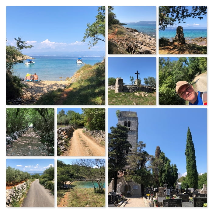

Meine Wanderung beginnt am Meergrundstück unseres Ferienhauses.
Ich folge der Küste, entlang an ganz vielen kleinen Buchten und vorbei am Gedenkkreuz bis ich an einen großen Weg stoße. Nun biege ich links ab und gehe ins Landesinnere.
Bald komme ich zum Fumak (61m) mit seinem weithin sichtbaren Kreuz auf dem Gipfel.
Ich folge dem geschotterten Weg weiter und komme dann zum Friedhof Groblije mit der Kirche Sv. Apolinara. Dieser Platz ist sehr schön und strahlt eine friedliche Ruhe aus!
Ich folge dem Weg weiter Richtung Porat und dann durch den Wald zu einer sehr schönen Badebucht.
Das letzte Stück folge ich wieder der Küste bis ich zurück an meinen Startpunkt komme.
Further information at
http://villatonka.com/index.php?/family-house-rent/croatia/our-nook-of-paradise-by-the-seaTour map and elevation profile
Minimum height
Maximum height 79 m
Comments

Start der Wanderung an den Koordinaten: N45° 07' 36.5" E14° 28' 42.2".
GPS tracks
Trackpoints-
GPX / Garmin Map Source (gpx) download
-
TCX / Garmin Training Center® (tcx) download
-
CRS / Garmin Training Center® (crs) download
-
Google Earth (kml) download
-
G7ToWin (g7t) download
-
TTQV (trk) download
-
Overlay (ovl) download
-
Fugawi (txt) download
-
Kompass (DAV) Track (tk) download
-
Track data sheet (pdf) download
-
Original file of the author (gpx) download
Add to my favorites
Remove from my favorites
Edit tags
Open track
My score
Rate