
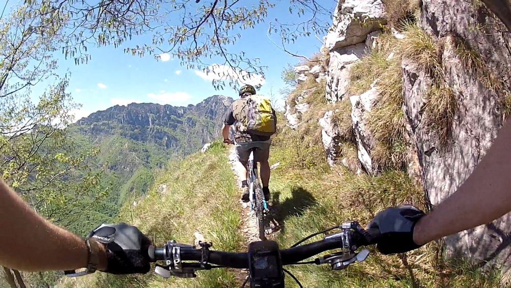

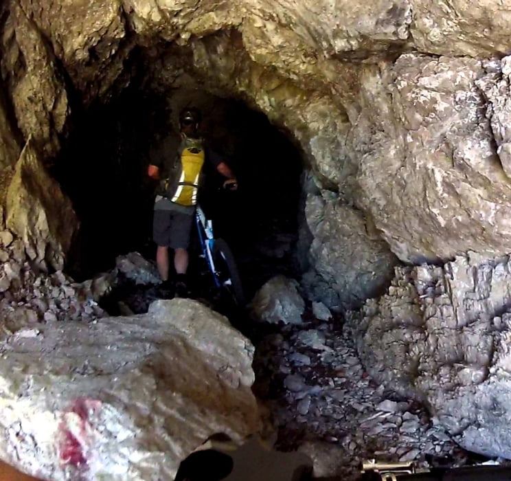
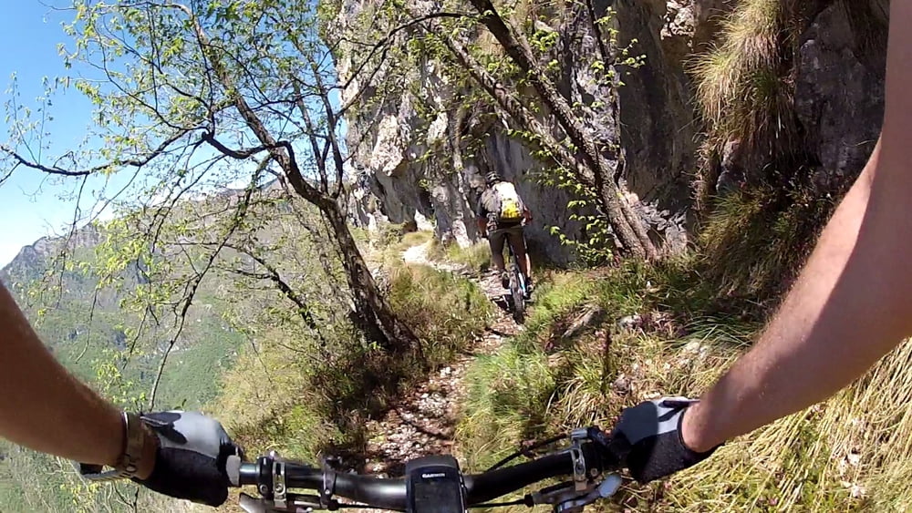
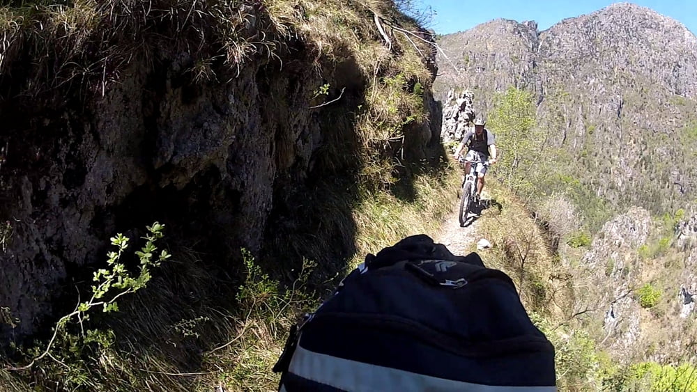
Ein der wohl spektakulärsten Singletrail Touren am Gardasee. Fahrstechnisch einfach aber teilweise sehr aussgesetzt! Wir starteten diesmal in Vesio um uns die 500hm von Limone (gute Fährverbindung von Riva) zu sparen. Nach 3 km einrollen geht es gleich 800hm eine Schotterstrasse mit im Schnitt 10% Steigung hinauf. Mit dem ersten Tunnel (teilweise verschüttet) beginnt dann eine Schiebe/ Fahr Passage auf einem handtuchbreiten Trail den steilen Kamm entlang. Nach ca 5.4 km wunderschönem Trail erreicht man die Bocca die Fobia. Hier ist aber das Trail Feuerwerk noch nicht zu Ende. Auf schmalem aber perfekt angelegtem Pfad geht es in zahlreichen Serpentinen stetig bergab durch eine einzigartige Felsenlandschaft bis zur Strasse auf den Passo Notta. Hier dann wieder 360hm bergauf und auf dem bereits beschriebenen Pregasinetrail (siehe Tour #181681) nach Riva retour.
Tour gallery
Tour map and elevation profile
Minimum height 65 m
Maximum height 1352 m

Comments

GPS tracks
Trackpoints-
GPX / Garmin Map Source (gpx) download
-
TCX / Garmin Training Center® (tcx) download
-
CRS / Garmin Training Center® (crs) download
-
Google Earth (kml) download
-
G7ToWin (g7t) download
-
TTQV (trk) download
-
Overlay (ovl) download
-
Fugawi (txt) download
-
Kompass (DAV) Track (tk) download
-
Track data sheet (pdf) download
-
Original file of the author (gpx) download
Add to my favorites
Remove from my favorites
Edit tags
Open track
My score
Rate