


Belchenherz - St. Trudpert - Talweg
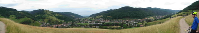
vom Ferienhaus Belchenherz aus geht es unterhalb der Eichbodens zwischen Weiden zu Kloster St.Trudpert. Es ist während der Fahrt im ein Blick ins Tal möglich. Kurz vor dem Kloster geht es nochmals am Prestenberg gut bergan.
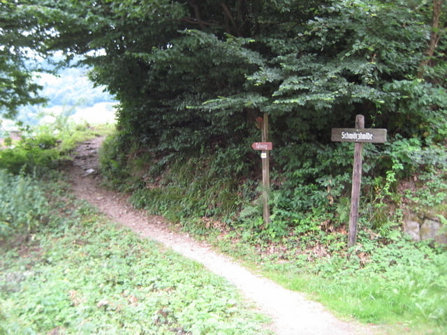
Am Kloster wechselt man die Hangseite und fährt auf dem Talweg raus Richtung Laisacker. Anfangs ist der Weg noch schmal und schwierig zu fahren. Später ist er gut ausgebaut.
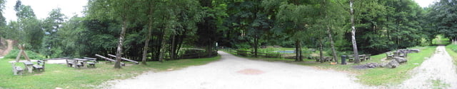
Im Etzenbach ist ein Spielplatz und eine Wassertrettanlage. Von dort geht es wieder runter ins Tal. Auf dem Radweg geht bis zum Bahnhof. Die restliche Strecke ist zeitweise auf der Strasse.
Viel Spaß beim biken.
Strecke ist auch für Nordic Walking geeignet.
Viel Spaß beim Radelnoder Walken . Wenn Sie Lust auf tolle Rennrad-, Bike- und Wanderstrecken im Südschwarzwald haben besuchen sie uns doch einfach für ein paar Tage. Es lohnt sich!
Further information at
http://www.belchenherz.deTour gallery
Tour map and elevation profile
Minimum height 368 m
Maximum height 476 m
More about the tour author
|
|
Belchenherz |
Comments

GPS tracks
Trackpoints-
GPX / Garmin Map Source (gpx) download
-
TCX / Garmin Training Center® (tcx) download
-
CRS / Garmin Training Center® (crs) download
-
Google Earth (kml) download
-
G7ToWin (g7t) download
-
TTQV (trk) download
-
Overlay (ovl) download
-
Fugawi (txt) download
-
Kompass (DAV) Track (tk) download
-
Track data sheet (pdf) download
-
Original file of the author (gpx) download
More about the tour author
|
|
Belchenherz |
Add to my favorites
Remove from my favorites
Edit tags
Open track
My score
Rate