


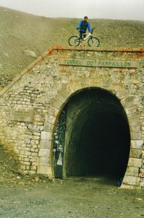
für diese tour braucht man auf alle fälle eine lichtstarke taschenlampe um die tunneldurchfahrt zu machen. er ist nämlich 500 m lang!!!
start ist das hotel in saint-paul-sur-ubaye. auf der D902 gehts erstmal auf teer über tournoux und gleizolles bis nach La Condamine-Châtelard.
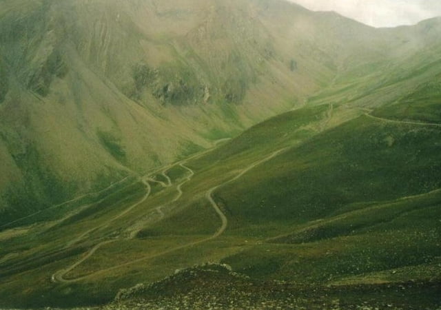
und hier geht jetzt der uphill zum tunnel los. über le grache und sainte-anne schrauben wir uns so langsam in die höhe.
der schotter geht los und so gehts uphill mäßig bis zum pass-tunnel parpaillon auf 2.644 m höhe! geschafft!
da wir wieder zurück ins hotel mußten, gehts auf gleichem weg zurück!
start ist das hotel in saint-paul-sur-ubaye. auf der D902 gehts erstmal auf teer über tournoux und gleizolles bis nach La Condamine-Châtelard.
und hier geht jetzt der uphill zum tunnel los. über le grache und sainte-anne schrauben wir uns so langsam in die höhe.
der schotter geht los und so gehts uphill mäßig bis zum pass-tunnel parpaillon auf 2.644 m höhe! geschafft!
da wir wieder zurück ins hotel mußten, gehts auf gleichem weg zurück!
Further information at
http://www.hegibiketours.deTour gallery


Tour map and elevation profile
Minimum height 1288 m
Maximum height 2644 m
More about the tour author
|
|
hegi |
Comments

Parken kann man in dem kleine Ort Saint-Paul!
GPS tracks
Trackpoints-
GPX / Garmin Map Source (gpx) download
-
TCX / Garmin Training Center® (tcx) download
-
CRS / Garmin Training Center® (crs) download
-
Google Earth (kml) download
-
G7ToWin (g7t) download
-
TTQV (trk) download
-
Overlay (ovl) download
-
Fugawi (txt) download
-
Kompass (DAV) Track (tk) download
-
Track data sheet (pdf) download
-
Original file of the author (gpx) download
More about the tour author
|
|
hegi |
Add to my favorites
Remove from my favorites
Edit tags
Open track
My score
Rate