


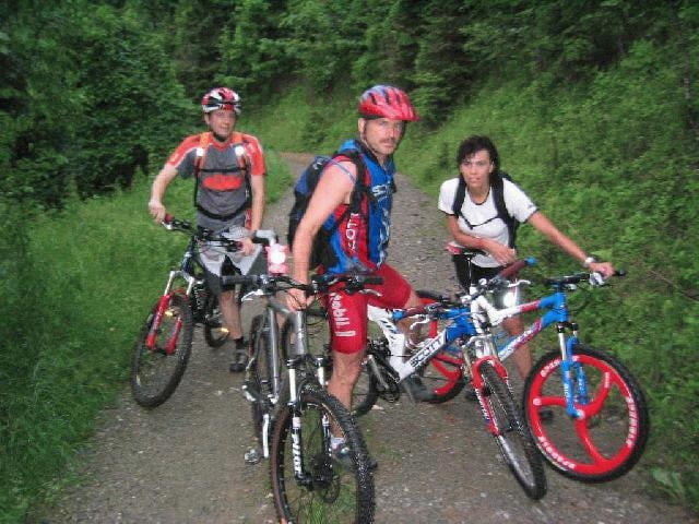
Beginnend Bei der Bahnunterführung, hat man zuerst einmal Zeit sich auf dem asphaltierten
Radweg aufzuwärmen. In Gratwein beginnt dann die erste kurze Steigung. Ab dem Stift Rein
geht es dann ab in den Wald über verwinkelte Schotterstraßen. Aufgepaßt auf Förster, denn
hier sind Mountainbiker nicht gerne gesehen. Am höchsten Punkt angekommen, geht es über
einen Wanderweg zum Schupfer Bertl. Nach einem Schnapstee (Gerüchten zufolge soll man einen
zweiten nicht überleben) oder einer Brettljause fährt es sich beschwingt wieder den Wanderweg
zurück. Die Abfahrt war leider aufgrund der Wetterlage (sehr kalt und naß -> ein Tee mußte sein ;-)
nur über Forststraßen möglich. Die nächstes Tour in der Gegend bringt ein paar Trials
Tour gallery
Tour map and elevation profile
Minimum height 372 m
Maximum height 1022 m
More about the tour author

|
Comments

Abfahrt Deutschfeistritz auf der A9. Vom Gasthaus Tomahan Richtung Gratwein gleich nach der Bahnüberführung
GPS tracks
Trackpoints-
GPX / Garmin Map Source (gpx) download
-
TCX / Garmin Training Center® (tcx) download
-
CRS / Garmin Training Center® (crs) download
-
Google Earth (kml) download
-
G7ToWin (g7t) download
-
TTQV (trk) download
-
Overlay (ovl) download
-
Fugawi (txt) download
-
Kompass (DAV) Track (tk) download
-
Track data sheet (pdf) download
-
Original file of the author (g7t) download
More about the tour author
|
|
Add to my favorites
Remove from my favorites
Edit tags
Open track
My score
Rate