


Deze tocht start in de Commandeurstraat in Mechelen waarna we op de kruising links gaan richting het elzetterbos.
Van hier uit gaat de tocht naar door het vijlenerbos richting de grens met belgie bij de Wolfhaag.
Hierna gaan we uphill tot bijna aan het 3 landenpunt.....en dan omlaag naar het morsentterbos en het akenerbos.
Waarna we weer terug komen op het 3 landenpunt,waarna we afdalen naar het vijlenerbos richting Cotessen en dan richting terziet (hou hier rekening met de wandelaars!!)
Waarna we weer klimmen naar het Bovenste bos in Heijenrath,vanwaar de tocht via dalbissen weer in de Commandeursstraat in Mechelen eindigt.
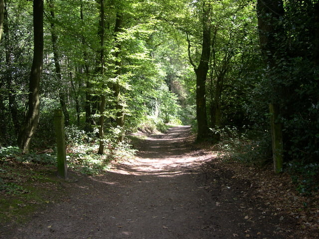
Deze tocht bevat meerdere mooie singletrails en leuke beklimmingen.
En er zit niet meer dan 15% asphalt in deze tocht.
This tour starts at the commandeur street in Mechelen where upon we on the junction left goes. Of here from the tour goes to by the vijlenerbos direction the border with Belgium at the wolfhaag . Here after we go almost to 3 the country point ..... and then downhill to the morsentterbos and the akenerbos. Where upon we turn back to the 3 country point, where upon we descend to the vijlenerbos direction Cotessen and then direction terziet (hou here account with the walkers!!) Where upon we climb to the upper bunch in Heijenrath, from where the excursion by means of dalbissen in the commandeur street in Mechelen finishes. This tour contains several beautiful singletrails and nice climbs. And there sits no longer than 15% asphalt in this excursion.
Dieser tour beginnt an der commandeur Straße in Mechelen, wohin auf wir auf der gelassenen Verzweigung gehen. Von hier vom Ausflug durch zur vijlenerbos Richtung wolfhaag geht die tour nach belgien Hier, nach dem wir fast bis 3 der Landpunkt ..... und dann abwärts zu den morsentterbos und zu den aachenerwald gehen. Wo uns auf wir zurück zu dem Punkt mit 3 Ländern drehen, in dem auf wir zur vijlenerbos Richtung Cotessen und dann zum Richtung terziet absteigen (Achtung fur die Wanderern!!) Mittels wo auf wir zum oberen wald in Heijenrath klettern, von, wo die tour uber dalbissen in der commandeur Straße in Mechelen beendet. Diese Tour enthält einige schöne singletrails und nette Aufstiege. Und sitzt nicht mehr als der 15% Asphalt in dieser Exkursion.
Tour gallery


Tour map and elevation profile
Minimum height 97 m
Maximum height 387 m
More about the tour author
|
|
BertAusten |
Comments

Mechelen Commandeurstraat 6281 AM
GPS tracks
Trackpoints-
GPX / Garmin Map Source (gpx) download
-
TCX / Garmin Training Center® (tcx) download
-
CRS / Garmin Training Center® (crs) download
-
Google Earth (kml) download
-
G7ToWin (g7t) download
-
TTQV (trk) download
-
Overlay (ovl) download
-
Fugawi (txt) download
-
Kompass (DAV) Track (tk) download
-
Track data sheet (pdf) download
-
Original file of the author (gpx) download
More about the tour author
|
|
BertAusten |
Add to my favorites
Remove from my favorites
Edit tags
Open track
My score
Rate