


Die Auffahrt erfolgt auf Asphalt bzw. gutem Forstweg und ab der Bodensteinhütte über einen etwas ausgewaschenen Schotterweg. Nach der Seegrube dann noch ein kurzes Stück schieben auf den Grubegg (kann man aussen rum aber auch fahren).
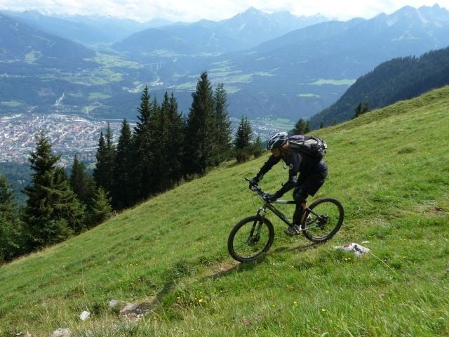
Die Abfahrt beginnt mit einer Querung von der man dann auf dem Trail 215 Richtung Höttinger Alm abzweigt und intensiv seine Serpentinentechnik üben kann (hier kann man ggf. auch einen Abzweig vorher nehmen - auch mit vielen Serpentinen)
Ab der Höttinger Alm wird er Trail dann flowiger. Ab Gramertboden haben wir dann nicht mehr den ganz richtigen Weg gefunden - geht wohl etwas weiter links...
Tour gallery
Tour map and elevation profile
Minimum height 591 m
Maximum height 1966 m
More about the tour author
|
|
tboettch |
Comments

Startpunkt ist an der Universitätsbrücke in Innsbruck in der Nähe vom Sport Spezial.
GPS tracks
Trackpoints-
GPX / Garmin Map Source (gpx) download
-
TCX / Garmin Training Center® (tcx) download
-
CRS / Garmin Training Center® (crs) download
-
Google Earth (kml) download
-
G7ToWin (g7t) download
-
TTQV (trk) download
-
Overlay (ovl) download
-
Fugawi (txt) download
-
Kompass (DAV) Track (tk) download
-
Track data sheet (pdf) download
-
Original file of the author (gpx) download
More about the tour author
|
|
tboettch |
Add to my favorites
Remove from my favorites
Edit tags
Open track
My score
Rate