Login

Forgot your login?

Cookies have to be accepted!
Your browser's cookie functionality is disabled. Please enable this functionality.

Not a member yet?

Register now
Login

Available for registred users only

Log in to use this feature.

Forgot your login?

Cookies have to be accepted!
Your browser's cookie functionality is disabled. Please enable this functionality.

Not a member yet?

Register now
Filter
Categories
Advanced filters
  • Distance (km)
  • Height
Save filters Reset filter

TrackRank

QRCode

Technical data

Distance38,5 km Height1980 m Way down1975 m Duration05:00 h:m Date27.08.2008
Scores Author Landscape Fun factor Fitness Technique

Statistics

2616 Views 2 Scores 576 Downloads 4.50 Average
Rate
  • Track data sheet
  • Directions
  • Downloads


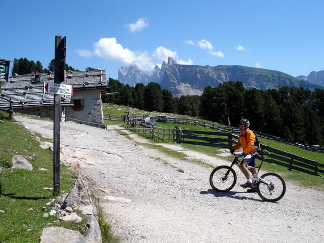
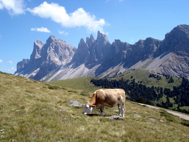
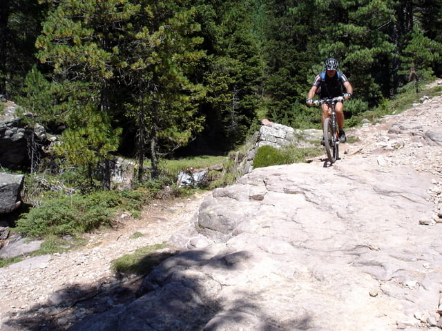
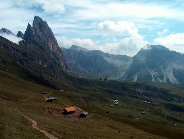
L’escursione è diretta al parco naturale Puez-Odle, uno dei paesaggi più spettacolari delle Dolomiti sotto le cime delle Odle. Si raggiunge Ortisei da Selva per salire al Rasciesa con lungo sentiero sterrato. La discesa dalla sella Brogles passa su uno dei single-track più belli di Europa fino alla stazione intermedia della funivia che ci porta in cima al Seceda (2.480 m.). Un altro single-track in tutta discesa per l’Alpe Cisles e la Vallunga ci riporta a Selva di Valgardena.

Further information at

http://www.sibillini-mtb.it

Tour gallery

Tour map and elevation profile

  • Open Street Map
  • Google
Minimum height 1238 m Maximum height 2464 m Detailed view

More about the tour author

barbonis
Member since 2008

Send private message

Comments

norinofu on 07.06.2009

Trail nach St. Ulrich

Moin, als Nordlicht bin ich den Trail am Kutschnerbach 2003 bei meinem ersten und bisher einzigen AlpenX bis nach St. Ulrich runter gefahren: Schönes Teil. Dies Jahr werde ich mal wieder in der Gegend sein und die Strecke noch mal unter die Stollen nehmen. Unser Guide sagte damals, er fährt manchmal extra von München da hin, nur für diesen Trail.
munter bleiben!
Ralf
funmaster66 on 25.08.2010

Flowige Trails

Eine echt super Tour die zum Empfehlen ist, die auch Landschaftlich eingiges zu bieten hat
Fahrtechnisch ist die Tour nicht so schwierig wie angegeben, da immer wieder Flowige S1 Trails vorhanden sind.
Die Fahrt mit der Gondel zur Seceda kostet 9€, man kann aber auch die 700hm selber rauffahren,ist aber eher nicht zu empfehlen da der Weg sehr Steil ausgesehen hat.

GPS tracks

Trackpoints
  • GPX / Garmin Map Source (gpx) download
  • TCX / Garmin Training Center® (tcx) download
  • CRS / Garmin Training Center® (crs) download
  • Google Earth (kml) download
  • G7ToWin (g7t) download
  • TTQV (trk) download
  • Overlay (ovl) download
  • Fugawi (txt) download
  • Kompass (DAV) Track (tk) download
  • Track data sheet (pdf) download
  • Original file of the author (gpx) download

More about the tour author

barbonis
Member since 2008

Send private message
Share track
Add to my favorites
Remove from my favorites
Edit tags
My score
Rate
Track: Rasciesa-Seceda
Type: Mountain bike
Distance: 38,5 km
Evaluated on:
Duration:
Day(s)
Hour(s)
Minute(s)
Score: Landscape Fun factor Fitness Technique