


Um zum Beginn des Tracks zu gelangen, muss man erst mal einen Parkplatz finden und das ist in Bischofshofen gar nicht so einfach, sofern man keine gebühren zahlen will. Es gibt aber ein gutes Parkleitsystem und man folge am besten den Hinweis "Schanze". Da stellt man sich hin, beachte aber die Hinweisschilder, wie lange man parken darf, also eventuell wäre eine Parkuhr hilfreich. Ich parkte am untern Parkplatz, gleich beim Friedhof.
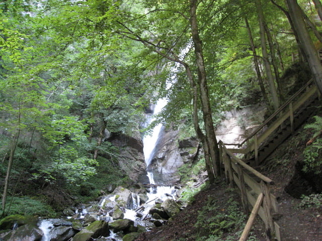
Man folge dem Track und man gelangt erstmals zur Sprungschanze. Dann geht es weiter Richtung Wasserfall. Da führen nicht wenige Stufen rauf, um dieses Naturdenkmall vollends zu genießen. Am Ende gelangt man zu einer Ruine und kann den schönen Ausblick zum Tennengebirge und auf Bischofshofen genießen. Der Rückweg geht nicht mehr über den Wasserfall, sondern gemütlich runter nach Bischofshofen zum Ausgangspunkt.
Further information at
http://www.bischofshofen.com/Tour gallery
Tour map and elevation profile
Minimum height 569 m
Maximum height 725 m
More about the tour author
|
|
hans29 |
Comments

Bischofshofen erreicht man am besten über die A10, die Tauenautobahn, soferne nicht gerade ein Hauptreisetag ist und die Autobahn zugestaut ist.
Auch für Bahnreisende ideal, ich kenne eigentlich keinen Zug, der nicht in Bischofshofen stoppt., wenige Ausnahmen wird es wohl sicher geben.
GPS tracks
Trackpoints-
GPX / Garmin Map Source (gpx) download
-
TCX / Garmin Training Center® (tcx) download
-
CRS / Garmin Training Center® (crs) download
-
Google Earth (kml) download
-
G7ToWin (g7t) download
-
TTQV (trk) download
-
Overlay (ovl) download
-
Fugawi (txt) download
-
Kompass (DAV) Track (tk) download
-
Track data sheet (pdf) download
-
Original file of the author (gpx) download
More about the tour author
|
|
hans29 |
Add to my favorites
Remove from my favorites
Edit tags
Open track
My score
Rate