Login

Forgot your login?

Cookies have to be accepted!
Your browser's cookie functionality is disabled. Please enable this functionality.

Not a member yet?

Register now
Login

Available for registred users only

Log in to use this feature.

Forgot your login?

Cookies have to be accepted!
Your browser's cookie functionality is disabled. Please enable this functionality.

Not a member yet?

Register now
Filter
Categories
Advanced filters
  • Distance (km)
  • Height
Save filters Reset filter

TrackRank

QRCode

Technical data

Distance8,2 km Height87 m Way down105 m Duration00:21 h:m Date02.09.2008
Scores Author Landscape Fun factor Fitness Technique

Statistics

66 Views Scores 11 Downloads Average
Rate
  • Track data sheet
  • Directions
  • Downloads

6.7.2008

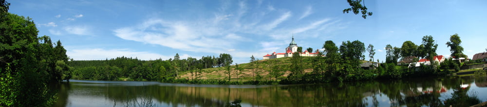
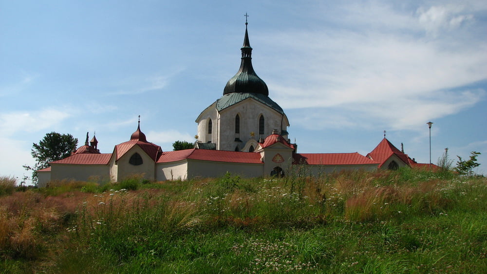
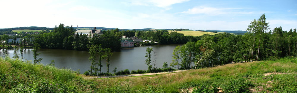
Počas cesty vlakom do Senohrab som čakal v Žďári nad Sázavou cca 45min, takže som sa rozhodol, že si pôjdem pozrieť kostol na Zelenej hore.

Tour gallery

Tour map and elevation profile

  • Open Street Map
  • Google
Minimum height 567 m Maximum height 615 m Detailed view

More about the tour author

tmax
Member since 2007

Send private message

Comments

Žďár nad Sázavou

GPS tracks

Trackpoints
  • GPX / Garmin Map Source (gpx) download
  • TCX / Garmin Training Center® (tcx) download
  • CRS / Garmin Training Center® (crs) download
  • Google Earth (kml) download
  • G7ToWin (g7t) download
  • TTQV (trk) download
  • Overlay (ovl) download
  • Fugawi (txt) download
  • Kompass (DAV) Track (tk) download
  • Track data sheet (pdf) download
  • Original file of the author (gpx) download

More about the tour author

tmax
Member since 2007

Send private message
Share track
Add to my favorites
Remove from my favorites
Edit tags
My score
Rate
Track: 20080706_2_Ku kostolu v Žďári nad Sázavou
Type: Mountain bike
Distance: 8,2 km
Evaluated on:
Duration:
Day(s)
Hour(s)
Minute(s)
Score: Landscape Fun factor Fitness Technique