Login

Forgot your login?

Cookies have to be accepted!
Your browser's cookie functionality is disabled. Please enable this functionality.

Not a member yet?

Register now
Login

Available for registred users only

Log in to use this feature.

Forgot your login?

Cookies have to be accepted!
Your browser's cookie functionality is disabled. Please enable this functionality.

Not a member yet?

Register now
Filter
Categories
Advanced filters
  • Distance (km)
  • Height
Save filters Reset filter

TrackRank

QRCode

Technical data

Distance59,2 km Height1257 m Way down1244 m Duration04:00 h:m Date11.09.2005
Scores Author User Landscape Fun factor Fitness Technique

Statistics

1293 Views 1 Score 438 Downloads 4.00 Average
Rate
  • Track data sheet
  • Directions
  • Downloads
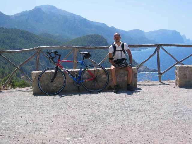
Im ständigen auf und ab führt die Tour von Andrax an der Küstenstraße Richtung Valldemossa. Grandiose Ausblicke kann man genießen auf die westliche Steilküste von Mallorca. Die Runde wird geschlossen über Puigpunyent und Es Captella. Auch im Landesinneren hält die Tour schönste Ausblicke bereit.

Tour gallery

Tour map and elevation profile

  • Open Street Map
  • Google
Minimum height 72 m Maximum height 458 m Detailed view

More about the tour author

ingo
Member since 2001

Send private message

Comments

GPS tracks

Trackpoints
  • GPX / Garmin Map Source (gpx) download
  • TCX / Garmin Training Center® (tcx) download
  • CRS / Garmin Training Center® (crs) download
  • Google Earth (kml) download
  • G7ToWin (g7t) download
  • TTQV (trk) download
  • Overlay (ovl) download
  • Fugawi (txt) download
  • Kompass (DAV) Track (tk) download
  • Track data sheet (pdf) download
  • Original file of the author (g7t) download

More about the tour author

ingo
Member since 2001

Send private message
Share track
Add to my favorites
Remove from my favorites
Edit tags
My score
Rate
Track: Andrax
Type: Road biking
Distance: 59,2 km
Evaluated on:
Duration:
Day(s)
Hour(s)
Minute(s)
Score: Landscape Fun factor Fitness Technique