Login

Forgot your login?

Cookies have to be accepted!
Your browser's cookie functionality is disabled. Please enable this functionality.

Not a member yet?

Register now
Login

Available for registred users only

Log in to use this feature.

Forgot your login?

Cookies have to be accepted!
Your browser's cookie functionality is disabled. Please enable this functionality.

Not a member yet?

Register now
Filter
Categories
Advanced filters
  • Distance (km)
  • Height
Save filters Reset filter

TrackRank

QRCode

Technical data

Distance68,0 km Height1462 m Way down1421 m Duration06:30 h:m Date13.09.2008
Scores Author Landscape Fun factor Fitness Technique

Statistics

1381 Views 1 Score 321 Downloads 5.00 Average
Rate
  • Track data sheet
  • Directions
  • Downloads

Schwangau-Ehrwald-Nassereith

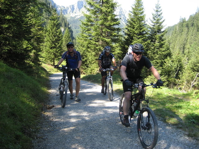
Start bei den Königschlössern, über die Jägeralpe zum Plansee und weiter nach Österreich nach Bichelbach.Vorbei an Leermos durch Ehrwald. In der Nähe der Fernpassstraße über den selben nach Nassereith zu unserer ersten Übernachtung:Hotel Seeblick

Tour map and elevation profile

  • Open Street Map
  • Google
Minimum height 787 m Maximum height 1416 m Detailed view

More about the tour author

Kammerbulle
Member since 2008

Send private message

Comments

GPS tracks

Trackpoints
  • GPX / Garmin Map Source (gpx) download
  • TCX / Garmin Training Center® (tcx) download
  • CRS / Garmin Training Center® (crs) download
  • Google Earth (kml) download
  • G7ToWin (g7t) download
  • TTQV (trk) download
  • Overlay (ovl) download
  • Fugawi (txt) download
  • Kompass (DAV) Track (tk) download
  • Track data sheet (pdf) download
  • Original file of the author (gpx) download

More about the tour author

Kammerbulle
Member since 2008

Send private message
Share track
Add to my favorites
Remove from my favorites
Edit tags
My score
Rate
Track: Alpencross 08 Füssen-Riva Tag 1
Type: Mountain bike
Distance: 68,0 km
Evaluated on:
Duration:
Day(s)
Hour(s)
Minute(s)
Score: Landscape Fun factor Fitness Technique