Login

Forgot your login?

Cookies have to be accepted!
Your browser's cookie functionality is disabled. Please enable this functionality.

Not a member yet?

Register now
Login

Available for registred users only

Log in to use this feature.

Forgot your login?

Cookies have to be accepted!
Your browser's cookie functionality is disabled. Please enable this functionality.

Not a member yet?

Register now
Filter
Categories
Advanced filters
  • Distance (km)
  • Height
Save filters Reset filter

TrackRank

QRCode

Technical data

Distance37,0 km Height586 m Way down588 m Duration02:20 h:m Date15.09.2008
Scores Author User Landscape Fun factor Fitness Technique

Statistics

1242 Views 2 Scores 100 Downloads 3.50 Average
Rate
  • Track data sheet
  • Directions
  • Downloads

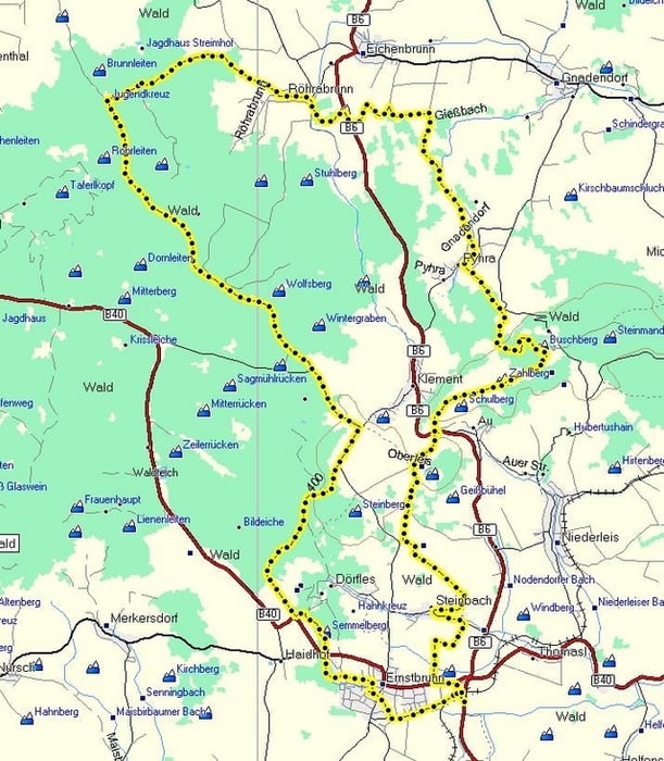
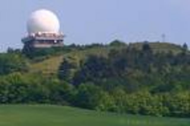
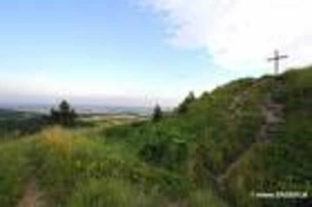
Eine MTB Tour die wenige Wünsche offen lässt. Die Strecke führt auf Schotter-, Forst- und Feldwegen. Gespickt mit Trails, knackigen Uphills und rasanten Abfahrten. Den höchsten Punkt und zugleich beste Fernsicht hast du am Buschberg (492 M).

Einteilung ist die halbe Tour .... also nicht gleich zu Beginn alles verheizen.

Tour gallery

Tour map and elevation profile

  • Open Street Map
  • Google
Minimum height 255 m Maximum height 482 m Detailed view

More about the tour author

LeiseRadler
Member since 2008

Send private message

Comments

MatsiRamirez on 21.03.2010

Richtung

fährst du den track im oder gegen den uhrzeigersinn?

lg

Hallo Matzi! Bin schon öfters beide Richtungen gefahren. Meine Vorliebe ist jedoch im Uhrzeigersinn. Die Abfahrt vom Buschberg kannst du auch mit der Tour 25257: Buschberg - Draisinenalm kombinieren. LG Hans
eipeldauer on 25.08.2011

Super!

Danke für diese schöne Tour! Bin sie von Röhrabrunn aus gefahren (im Uhrzeigersinn). War einfach nur schön!

Freut mich wenn´s dir gefallen hat. LG LeiseRadler

GPS tracks

Trackpoints
  • GPX / Garmin Map Source (gpx) download
  • TCX / Garmin Training Center® (tcx) download
  • CRS / Garmin Training Center® (crs) download
  • Google Earth (kml) download
  • G7ToWin (g7t) download
  • TTQV (trk) download
  • Overlay (ovl) download
  • Fugawi (txt) download
  • Kompass (DAV) Track (tk) download
  • Track data sheet (pdf) download
  • Original file of the author (gpx) download

More about the tour author

LeiseRadler
Member since 2008

Send private message
Share track
Add to my favorites
Remove from my favorites
Edit tags
My score
Rate
Track: Buschberg Classik Varinate 2
Type: Mountain bike
Distance: 37,0 km
Evaluated on:
Duration:
Day(s)
Hour(s)
Minute(s)
Score: Landscape Fun factor Fitness Technique