


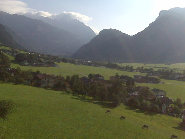
Ein kühler Gipfel kann man sagen wenn Du bei 3 Grad auf dem Penkenjoch auf 2.100m ankommst. Es war aber auch schon Ende September.
Insgesamt ein schöne Tour. Auffahrt ab Finkenberg weitestgehend über Forststraßen, an der Finkenberger Almbahnen Mittelstation vorbei bis zum Penkenjoch. Dort in der Hütte eine gute Brotzeit und das super Panorama genießen (und aufwärmen).
Flott bergab über die Schotterstraßen mit einem kleinen, nicht allzu schweren Singletrail bei Finkenberg.
Further information at
http://www.mountainandsoul.at/Tour gallery
Tour map and elevation profile
Minimum height 597 m
Maximum height 2092 m
More about the tour author
|
|
seppfe |
Comments

Start in Mayrhofen oder Finkenberg. Wir hatten es uns tags zuvor in einem Hotel gemütlich gemacht, daher Start und Ende der Tour in Ramsau.
GPS tracks
Trackpoints-
GPX / Garmin Map Source (gpx) download
-
TCX / Garmin Training Center® (tcx) download
-
CRS / Garmin Training Center® (crs) download
-
Google Earth (kml) download
-
G7ToWin (g7t) download
-
TTQV (trk) download
-
Overlay (ovl) download
-
Fugawi (txt) download
-
Kompass (DAV) Track (tk) download
-
Track data sheet (pdf) download
-
Original file of the author (gpx) download
More about the tour author
|
|
seppfe |
Add to my favorites
Remove from my favorites
Edit tags
Open track
My score
Rate