


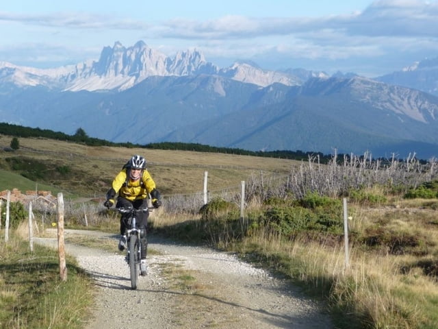
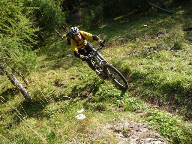
Leichte Auffahrt auf Asphalt und Schotter. Tolles Panorama. Flowiger Singletrail bei der Abfahrt nach Unterreinswald. Ab da leider ein paar Abfahrtshöhenmeter auf Asphalt.
Einkehrmöglichkeiten gibt es diverse auf der Tour.
Tour gallery
Tour map and elevation profile
Minimum height 800 m
Maximum height 2165 m
More about the tour author
|
|
tboettch |
Comments

Gestartet sind wir in Bundschen (Ponticino) im Sarntal. Dies erreicht man von der Autobahn entweder über die Abfahrt Sterzing und dann über das Penser Joch oder über die Abfahrt Bozen Nord und dann durch Bozen.
GPS tracks
Trackpoints-
GPX / Garmin Map Source (gpx) download
-
TCX / Garmin Training Center® (tcx) download
-
CRS / Garmin Training Center® (crs) download
-
Google Earth (kml) download
-
G7ToWin (g7t) download
-
TTQV (trk) download
-
Overlay (ovl) download
-
Fugawi (txt) download
-
Kompass (DAV) Track (tk) download
-
Track data sheet (pdf) download
-
Original file of the author (gpx) download
More about the tour author
|
|
tboettch |
Add to my favorites
Remove from my favorites
Edit tags
Open track
My score
Rate