Login

Forgotten password?

Cookies have to be accepted!
Your browser's cookie functionality is disabled. Please enable this functionality.

Not a member yet?

Register now
Login

Available for registred users only

Log in to use this feature.

Forgotten password?

Cookies have to be accepted!
Your browser's cookie functionality is disabled. Please enable this functionality.

Not a member yet?

Register now
Filter
Categories
Advanced filters
  • Distance (km)
  • Height
Save filters Reset filter

TrackRank

QRCode

Technical data

Distance17,7 km Height844 m Way down844 m Duration05:00 h:m Date02.10.2008
Scores Author Landscape Fun factor Fitness Technique

Statistics

1759 Views Scores 211 Downloads Average
Rate
  • Track data sheet
  • Directions
  • Downloads
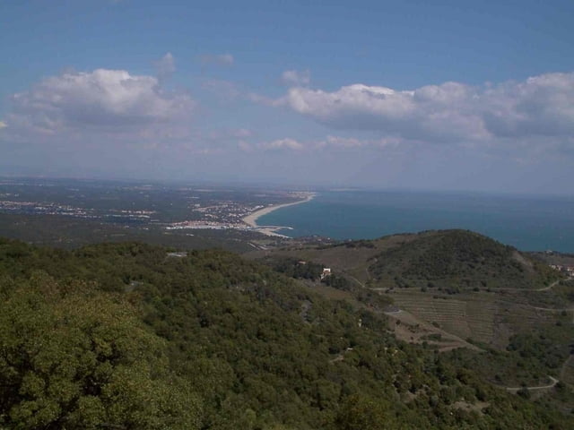
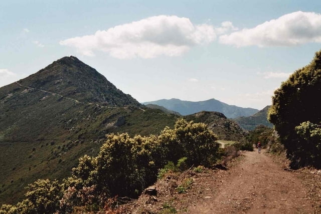
Von Port-Vendres vorbei Fort am Sainte-Elme über den Col del Mollo und der Batterie de Taillefer zum Tour de Madeloc. Dieser Gipfel bietet als erster Vorgipfel der Pyrenäen einen schönen Ausblick über das Mittelmeer und nach Perpingan sowie auf die ersten höheren Berge der Pyrenäen

Tour gallery

Tour map and elevation profile

  • Open Street Map
  • Google
Minimum height 16 m Maximum height 630 m Detailed view

More about the tour author

msdetroit
Member since 2007

Send private message

Comments

GPS tracks

Trackpoints
  • GPX / Garmin Map Source (gpx) download
  • TCX / Garmin Training Center® (tcx) download
  • CRS / Garmin Training Center® (crs) download
  • Google Earth (kml) download
  • G7ToWin (g7t) download
  • TTQV (trk) download
  • Overlay (ovl) download
  • Fugawi (txt) download
  • Kompass (DAV) Track (tk) download
  • Track data sheet (pdf) download
  • Original file of the author (gpx) download

More about the tour author

msdetroit
Member since 2007

Send private message
Share track
Add to my favorites
Remove from my favorites
Edit tags
My score
Rate
Track: Von Port-Vendres zum Tour de Madeloc
Type: Hiking
Distance: 17,7 km
Evaluated on:
Duration:
Day(s)
Hour(s)
Minute(s)
Score: Landscape Fun factor Fitness Technique