Login

Forgot your login?

Cookies have to be accepted!
Your browser's cookie functionality is disabled. Please enable this functionality.

Not a member yet?

Register now
Login

Available for registred users only

Log in to use this feature.

Forgot your login?

Cookies have to be accepted!
Your browser's cookie functionality is disabled. Please enable this functionality.

Not a member yet?

Register now
Filter
Categories
Advanced filters
  • Distance (km)
  • Height
Save filters Reset filter

TrackRank

QRCode

Technical data

Distance10,4 km Height610 m Way down589 m Duration03:10 h:m Date03.10.2008
Scores Author Landscape Fun factor Fitness Technique

Statistics

497 Views Scores 116 Downloads Average
Rate
  • Track data sheet
  • Directions
  • Downloads

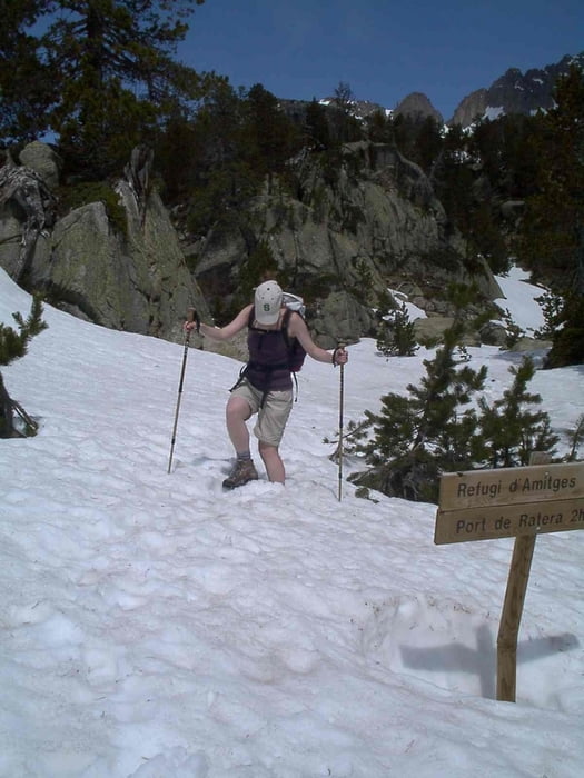
Rundkurs im Schnee im Nationapark von Esport um den Estany Mauricy zur Amtiges-Hütte. Die Tour beginnt am Ende des "Bergtaxis" knapp unterhalb der Staumauer. Der rückweg führt an den Cascda de Ratera vorbei. Mit Glück sind Gemsen und Mürmeltiere zu beobachten.

****(*)-Tour

Tour gallery

Tour map and elevation profile

  • Open Street Map
  • Google
Minimum height 1878 m Maximum height 2360 m Detailed view

More about the tour author

msdetroit
Member since 2007

Send private message

Comments

GPS tracks

Trackpoints
  • GPX / Garmin Map Source (gpx) download
  • TCX / Garmin Training Center® (tcx) download
  • CRS / Garmin Training Center® (crs) download
  • Google Earth (kml) download
  • G7ToWin (g7t) download
  • TTQV (trk) download
  • Overlay (ovl) download
  • Fugawi (txt) download
  • Kompass (DAV) Track (tk) download
  • Track data sheet (pdf) download
  • Original file of the author (gpx) download

More about the tour author

msdetroit
Member since 2007

Send private message
Share track
Add to my favorites
Remove from my favorites
Edit tags
My score
Rate
Track: Estany de Sant Maurici zm Xalet d'Amtiges
Type: Hiking
Distance: 10,4 km
Evaluated on:
Duration:
Day(s)
Hour(s)
Minute(s)
Score: Landscape Fun factor Fitness Technique