Login

Forgot your login?

Cookies have to be accepted!
Your browser's cookie functionality is disabled. Please enable this functionality.

Not a member yet?

Register now
Login

Available for registred users only

Log in to use this feature.

Forgot your login?

Cookies have to be accepted!
Your browser's cookie functionality is disabled. Please enable this functionality.

Not a member yet?

Register now
Filter
Categories
Advanced filters
  • Distance (km)
  • Height
Save filters Reset filter

TrackRank

QRCode

Technical data

Distance11,2 km Height399 m Way down399 m Duration03:20 h:m Date04.10.2008
Scores Author Landscape Fun factor Fitness Technique

Statistics

502 Views Scores 70 Downloads Average
Rate
  • Track data sheet
  • Directions
  • Downloads
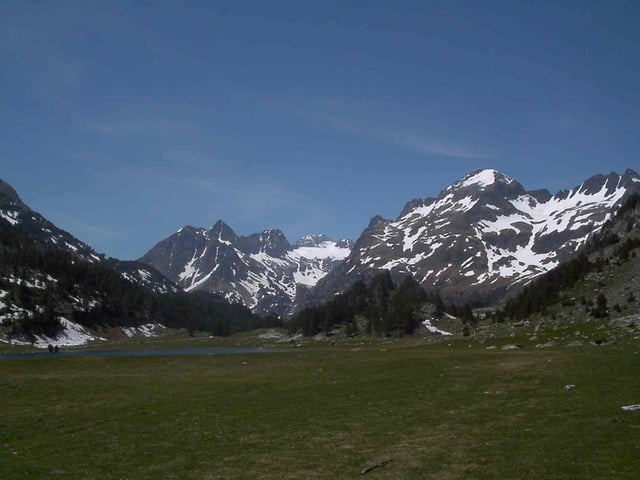
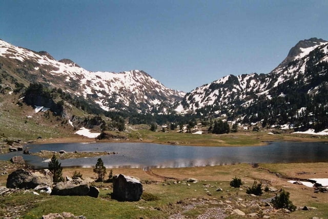
Vom Hospital de Benasque über La Besurta zum Forau de Aigallut. Dort verschwinden das Schmelzwasser der umliegenden Gleitscher im Maladeta Massiv und werden im Val d'Aran wieder das Tageslicht erblicken.

Tour gallery

Tour map and elevation profile

  • Open Street Map
  • Google
Minimum height 1747 m Maximum height 2042 m Detailed view

More about the tour author

msdetroit
Member since 2007

Send private message

Comments

GPS tracks

Trackpoints
  • GPX / Garmin Map Source (gpx) download
  • TCX / Garmin Training Center® (tcx) download
  • CRS / Garmin Training Center® (crs) download
  • Google Earth (kml) download
  • G7ToWin (g7t) download
  • TTQV (trk) download
  • Overlay (ovl) download
  • Fugawi (txt) download
  • Kompass (DAV) Track (tk) download
  • Track data sheet (pdf) download
  • Original file of the author (gpx) download

More about the tour author

msdetroit
Member since 2007

Send private message
Share track
Add to my favorites
Remove from my favorites
Edit tags
My score
Rate
Track: Hospital de Benasque zur Forau de Aiguallut
Type: Hiking
Distance: 11,2 km
Evaluated on:
Duration:
Day(s)
Hour(s)
Minute(s)
Score: Landscape Fun factor Fitness Technique