Login

Forgot your login?

Cookies have to be accepted!
Your browser's cookie functionality is disabled. Please enable this functionality.

Not a member yet?

Register now
Login

Available for registred users only

Log in to use this feature.

Forgot your login?

Cookies have to be accepted!
Your browser's cookie functionality is disabled. Please enable this functionality.

Not a member yet?

Register now
Filter
Categories
Advanced filters
  • Distance (km)
  • Height
Save filters Reset filter

TrackRank

QRCode

Technical data

Distance27,2 km Height578 m Way down579 m Duration00:00 h:m Date13.10.2005
Scores Author Landscape Fun factor Fitness Technique

Statistics

2091 Views Scores 762 Downloads Average
Rate
  • Track data sheet
  • Directions
  • Downloads
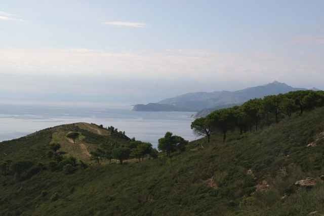
Entspanntes Cuisen kreuz und quer auf der Calamita-Halbinsel. Teilstrecken der alten MTB-Weltcup-Strecke von anno-dazumal sind enthalten, die Sandstrände sind auch nicht weit weg. Auf der Punta Calamita finden sich aber noch etliche Pisten...

Tour gallery

Tour map and elevation profile

  • Open Street Map
  • Google
Minimum height 162 m Maximum height 403 m Detailed view

More about the tour author

hd

Comments

Startpunkt ist Ortsmitte Capoliveri

GPS tracks

Trackpoints
  • GPX / Garmin Map Source (gpx) download
  • TCX / Garmin Training Center® (tcx) download
  • CRS / Garmin Training Center® (crs) download
  • Google Earth (kml) download
  • G7ToWin (g7t) download
  • TTQV (trk) download
  • Overlay (ovl) download
  • Fugawi (txt) download
  • Kompass (DAV) Track (tk) download
  • Track data sheet (pdf) download
  • Original file of the author (g7t) download

More about the tour author

hd

Share track
Add to my favorites
Remove from my favorites
Edit tags
My score
Rate
Track: Punta Calamita
Type: Mountain bike
Distance: 27,2 km
Evaluated on:
Duration:
Day(s)
Hour(s)
Minute(s)
Score: Landscape Fun factor Fitness Technique