Login

Forgot your login?

Cookies have to be accepted!
Your browser's cookie functionality is disabled. Please enable this functionality.

Not a member yet?

Register now
Login

Available for registred users only

Log in to use this feature.

Forgot your login?

Cookies have to be accepted!
Your browser's cookie functionality is disabled. Please enable this functionality.

Not a member yet?

Register now
Filter
Categories
Advanced filters
  • Distance (km)
  • Height
Save filters Reset filter

TrackRank

QRCode

Technical data

Distance22,3 km Height615 m Way down618 m Duration03:00 h:m Date06.10.2008
Scores Author User Landscape Fun factor Fitness Technique

Statistics

1378 Views 1 Score 365 Downloads 4.00 Average
Rate
  • Track data sheet
  • Directions
  • Downloads

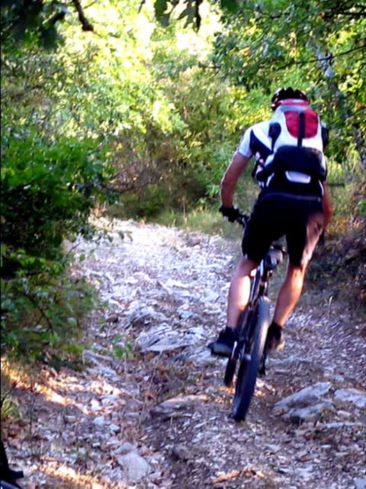
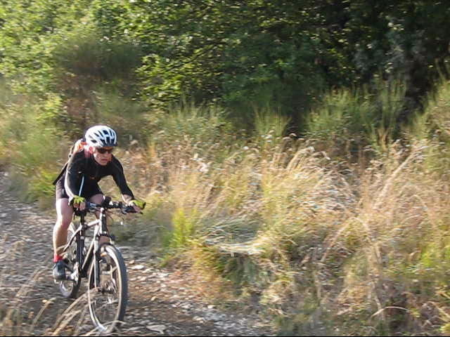
Eine super Trainingsrunde im Osten von Florenz. Aufstiege mit Steigungen bis ca. 22 % und ein Megatrail bei der Abfahrt. Dieser ist zwar nicht allzu schwierig, aber aufgrund derLänge von 4 km anspruchsvoll für Mensch und Material.

Tour gallery

Tour map and elevation profile

  • Open Street Map
  • Google
Minimum height 56 m Maximum height 568 m Detailed view

More about the tour author

typhoon2
Member since 2008

Send private message

Comments

sege69 on 29.07.2015

Tolle Tour

Nach langem Suchen, endlich diese Tour im Nord-Osten von Florenz gefunden. Heftige Anstiege, werden teilweise mit traumhaften Blicken in die Umgebung von Florenz belohnt. Am Ende wartet eine tolle Abfahrt. Zum Beginn des Trails ist eine Kette über den Weg gespannt, welche aber auch das einzige "Hindernis" in der Abfahrt ist. Der Downhill wartet mit teilweise anspruchsvollen Passagen auf. Insgesamt eine super Tour.
Autobahn in Florenz Süd verlassen und im Ortsteil Florenz Rovezzano entlang der Via di Rocca Tedalda parken. Am besten in Höhe des Bike shops an der Kreuzung zur Stradone di Rovezzano.

GPS tracks

Trackpoints
  • GPX / Garmin Map Source (gpx) download
  • TCX / Garmin Training Center® (tcx) download
  • CRS / Garmin Training Center® (crs) download
  • Google Earth (kml) download
  • G7ToWin (g7t) download
  • TTQV (trk) download
  • Overlay (ovl) download
  • Fugawi (txt) download
  • Kompass (DAV) Track (tk) download
  • Track data sheet (pdf) download
  • Original file of the author (gpx) download

More about the tour author

typhoon2
Member since 2008

Send private message
Share track
Add to my favorites
Remove from my favorites
Edit tags
My score
Rate
Track: Bester Trailspaß oberhalb von Florenz
Type: Mountain bike
Distance: 22,3 km
Evaluated on:
Duration:
Day(s)
Hour(s)
Minute(s)
Score: Landscape Fun factor Fitness Technique