Login

Forgot your login?

Cookies have to be accepted!
Your browser's cookie functionality is disabled. Please enable this functionality.

Not a member yet?

Register now
Login

Available for registred users only

Log in to use this feature.

Forgot your login?

Cookies have to be accepted!
Your browser's cookie functionality is disabled. Please enable this functionality.

Not a member yet?

Register now
Filter
Categories
Advanced filters
  • Distance (km)
  • Height
Save filters Reset filter

TrackRank

QRCode

Technical data

Distance24,2 km Height773 m Way down754 m Duration00:00 h:m Date14.10.2005
Scores Author Landscape Fun factor Fitness Technique

Statistics

2662 Views Scores 936 Downloads Average
Rate
  • Track data sheet
  • Directions
  • Downloads
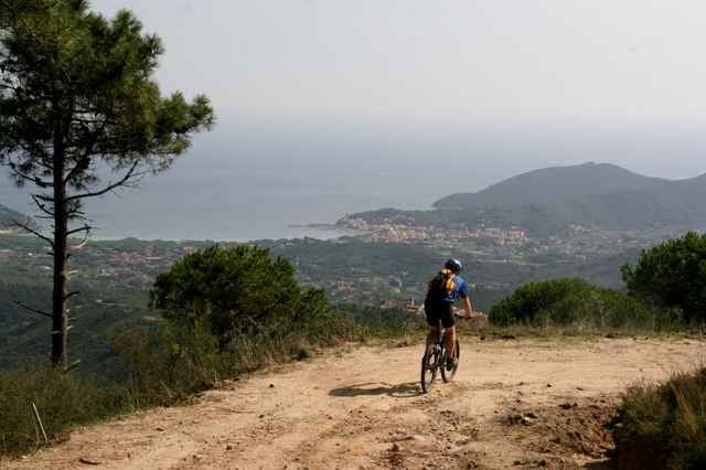
Von St. Ilario auf Sandpisten nach Poggio, eine Schleife auf Strasse nach Marciana, unter der Seilbahn durch, zurück nach Poggio und rauf zum Monte Perone. Toller Blick auf Elba. Von dort nur noch runter nach St. Ilario.

Tour gallery

Tour map and elevation profile

  • Open Street Map
  • Google
Minimum height 157 m Maximum height 612 m Detailed view

More about the tour author

hd

Comments

Start am von hinter St. Ilario

GPS tracks

Trackpoints
  • GPX / Garmin Map Source (gpx) download
  • TCX / Garmin Training Center® (tcx) download
  • CRS / Garmin Training Center® (crs) download
  • Google Earth (kml) download
  • G7ToWin (g7t) download
  • TTQV (trk) download
  • Overlay (ovl) download
  • Fugawi (txt) download
  • Kompass (DAV) Track (tk) download
  • Track data sheet (pdf) download
  • Original file of the author (g7t) download

More about the tour author

hd

Share track
Add to my favorites
Remove from my favorites
Edit tags
My score
Rate
Track: Monte Perone
Type: Mountain bike
Distance: 24,2 km
Evaluated on:
Duration:
Day(s)
Hour(s)
Minute(s)
Score: Landscape Fun factor Fitness Technique