Login

Forgot your login?

Cookies have to be accepted!
Your browser's cookie functionality is disabled. Please enable this functionality.

Not a member yet?

Register now
Login

Available for registred users only

Log in to use this feature.

Forgot your login?

Cookies have to be accepted!
Your browser's cookie functionality is disabled. Please enable this functionality.

Not a member yet?

Register now
Filter
Categories
Advanced filters
  • Distance (km)
  • Height
Save filters Reset filter

TrackRank

QRCode

Technical data

Distance32,1 km Height53 m Way down54 m Duration02:38 h:m Date17.10.2005
Scores Author Landscape Fun factor Fitness Technique

Statistics

458 Views Scores 25 Downloads Average
Rate
  • Track data sheet
  • Directions
  • Downloads
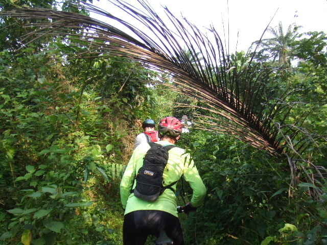
A long exhausting tour where we lost twice our way pretending we knew where we were going. It was a fun one though, with a nice rivercrossing (approx 90cm depth) and some nice little trails. Just one flat tyre in the very end of the tour. We were pretty lucky to be back on time. 20 minutes later and we would have been soaking wet as it started to really piss down heavily.

Tour gallery

Tour map and elevation profile

  • Open Street Map
  • Google
Minimum height 14 m Maximum height 28 m Detailed view

More about the tour author

mrunte
Member since 2005

Country: Qatar

22 created tours
7
Send private message

Comments

As usual we meet every Saturday at 14:30h Intels Camp

GPS tracks

Trackpoints
  • GPX / Garmin Map Source (gpx) download
  • TCX / Garmin Training Center® (tcx) download
  • CRS / Garmin Training Center® (crs) download
  • Google Earth (kml) download
  • G7ToWin (g7t) download
  • TTQV (trk) download
  • Overlay (ovl) download
  • Fugawi (txt) download
  • Kompass (DAV) Track (tk) download
  • Track data sheet (pdf) download
  • Original file of the author (gpx) download

More about the tour author

mrunte
Member since 2005

Country: Qatar

22 created tours
7
Send private message
Share track
Add to my favorites
Remove from my favorites
Edit tags
My score
Rate
Track: Bike Hash 009 - Port Harcourt "there is clearly a path"
Type: Mountain bike
Distance: 32,1 km
Evaluated on:
Duration:
Day(s)
Hour(s)
Minute(s)
Score: Landscape Fun factor Fitness Technique