
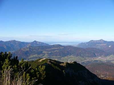

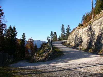
Diese im oberen Teil sehr steile Auffahrt ist schnell erklärt. Es handelt sich um eine reine Forstraßentour. Start ist links haltend vom Parkplatz der Bergbahn. Wir folgen den Weg am Landeplatz der Gleitschirmflieger vorbei bis zum Wegabzweig Biketour Bärenalm und folgen den Hauptweg zu dieser. Ab der Bärenalm geht's steil bergauf bis zur Bergstation. Wer hier noch nicht genug hat kann in 15min den Gipfel des Untersberghorns bezwingen. Zurück geht's den gleichen Weg.
Further information at
http://sigisfunwelt.de/Tour gallery
Tour map and elevation profile
Minimum height 621 m
Maximum height 1771 m
More about the tour author

|
sigi mitteregger |
Comments
GPS tracks
Trackpoints-
GPX / Garmin Map Source (gpx) download
-
TCX / Garmin Training Center® (tcx) download
-
CRS / Garmin Training Center® (crs) download
-
Google Earth (kml) download
-
G7ToWin (g7t) download
-
TTQV (trk) download
-
Overlay (ovl) download
-
Fugawi (txt) download
-
Kompass (DAV) Track (tk) download
-
Track data sheet (pdf) download
-
Original file of the author (g7t) download
More about the tour author
|
|
sigi mitteregger |
Add to my favorites
Remove from my favorites
Edit tags
Open track
My score
Rate
Schöne Tour! Danke