


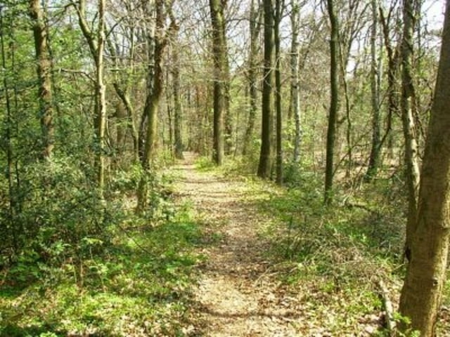
Lustiges "Schlammfahren" rund um die "Testerberge", bei dem Wetter teilweise schlammig mit tückischen "Löchern", meine Gabel hats mir gedankt. Sehr variable Strecke weil immer irgendwelche Abzweigungen sind. Einige Ansteigungen, Abfahrten, Sprünge (Erstellte). Dieses eine kurze Runde.
Tour gallery
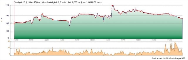
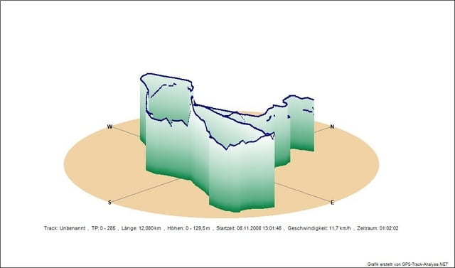
Tour map and elevation profile
Minimum height 51 m
Maximum height 130 m
More about the tour author
|
|
MikeWeis |
Comments

Gestartet am Parkplatz A3 Abfahrt Hünxe, von da aus ca. 1km Strasse entlang des Autobahnrastplatzes (Bergauf) und dann in den Wald zum "Spielen".
GPS tracks
Trackpoints-
GPX / Garmin Map Source (gpx) download
-
TCX / Garmin Training Center® (tcx) download
-
CRS / Garmin Training Center® (crs) download
-
Google Earth (kml) download
-
G7ToWin (g7t) download
-
TTQV (trk) download
-
Overlay (ovl) download
-
Fugawi (txt) download
-
Kompass (DAV) Track (tk) download
-
Track data sheet (pdf) download
-
Original file of the author (gpx) download
More about the tour author
|
|
MikeWeis |
Add to my favorites
Remove from my favorites
Edit tags
Open track
My score
Rate