


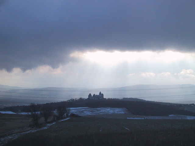
An der Donau entlang geht es zur Staustufe Greifenstein und von da aus weiter Richtung Stockerau. Jetzt beginnt der Anstieg auf den Waschberg mit schönen Blicken zurück auf Stockerau. Nach einer Abfahrt durch kaum befahrene Waldwege beginnt ein neuer Anstieg an dessen Ende ein wundervoller Blick auf die Burg Kreuzenstein freigegeben wird. Abfahrt nach Korneuburg über Feldwege und an der Donau zurück nach Wien.
Tour gallery
Tour map and elevation profile
Minimum height 89 m
Maximum height 401 m
More about the tour author

|
Wilk |
Comments

per Auto: Nordbrücke Abfahrt Döbling, Richtung Merkur Markt, Nordsteg, Nussdorfer Brücke
per U Bahn: Endstation U4 Heiligenstadt, Richtung Merkur Markt, Nordsteg, Nussdorfer Brücke
per U Bahn: Endstation U4 Heiligenstadt, Richtung Merkur Markt, Nordsteg, Nussdorfer Brücke
GPS tracks
Trackpoints-
GPX / Garmin Map Source (gpx) download
-
TCX / Garmin Training Center® (tcx) download
-
CRS / Garmin Training Center® (crs) download
-
Google Earth (kml) download
-
G7ToWin (g7t) download
-
TTQV (trk) download
-
Overlay (ovl) download
-
Fugawi (txt) download
-
Kompass (DAV) Track (tk) download
-
Track data sheet (pdf) download
-
Original file of the author (gpx) download
More about the tour author
|
|
Wilk |
Add to my favorites
Remove from my favorites
Edit tags
Open track
My score
Rate