


Die Bamberger Trails - Tiefenellern 02
Beschreibung:
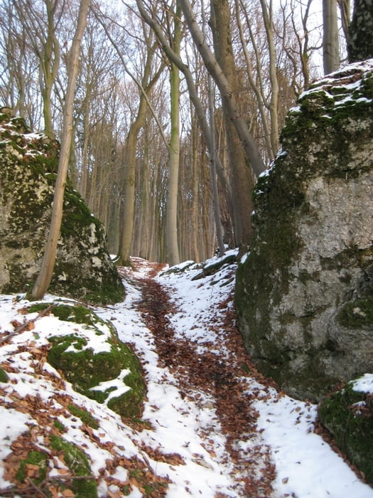
Dieser Trail führt von der Jungfernhöhle hinab nach Tiefenellern. Er ist nur bergab zu empfehlen, bergauf sind Teilstücke nicht fahrbar. Gleich am Anfang ist ein kurzes Stück, dass für ungeübte Fahrer durchaus zum Verhängnis werden könnte. Ansonsten handelt es sich um einen S1 (siehe www.singletrail-skala.de/) Trail, der landschaftlich, wie technisch sehr zu empfehlen ist.
Infos zur Jungfernhöhle gibts hier: de.wikipedia.org/wiki/Jungfernh%C3%B6hle
Kombinationsmöglichkeiten:
- Tiefenellern 01 (www.gps-tour.info/de/touren/detail.26974.htm)
- Tiefenellern 03 (www.gps-tour.info/de/touren/detail.27310.html)
- Tiefenellern 04 (www.gps-tour.info/de/touren/detail.27311.html)
- Stammberg 01 (www.gps-tour.info/de/touren/detail.27312.html)
- Stammberg 02 (www.gps-tour.info/de/touren/detail.27313.html)
Disskusionsforum:
www.mtb-news.de/forum/showthread.php
Further information at
http://www.mtb-news.de/forum/showthread.php?t=223706Tour gallery
Tour map and elevation profile
Minimum height 408 m
Maximum height 535 m
More about the tour author
|
|
Ben1000 |
Comments

Nach Tiefenellern, dann am besten Auffahrt über Tiefenellern 02 oder 04.
GPS tracks
Trackpoints-
GPX / Garmin Map Source (gpx) download
-
TCX / Garmin Training Center® (tcx) download
-
CRS / Garmin Training Center® (crs) download
-
Google Earth (kml) download
-
G7ToWin (g7t) download
-
TTQV (trk) download
-
Overlay (ovl) download
-
Fugawi (txt) download
-
Kompass (DAV) Track (tk) download
-
Track data sheet (pdf) download
-
Original file of the author (gpx) download
More about the tour author
|
|
Ben1000 |
Add to my favorites
Remove from my favorites
Edit tags
Open track
My score
Rate