Login

Forgot your login?

Cookies have to be accepted!
Your browser's cookie functionality is disabled. Please enable this functionality.

Not a member yet?

Register now
Login

Available for registred users only

Log in to use this feature.

Forgot your login?

Cookies have to be accepted!
Your browser's cookie functionality is disabled. Please enable this functionality.

Not a member yet?

Register now
Filter
Categories
Advanced filters
  • Distance (km)
  • Height
Save filters Reset filter

TrackRank

QRCode

Technical data

Distance22,5 km Height493 m Way down504 m Duration02:10 h:m Date14.12.2008
Scores Author Landscape Fun factor Fitness Technique

Statistics

615 Views 2 Scores 126 Downloads 4.00 Average
Rate
  • Track data sheet
  • Directions
  • Downloads

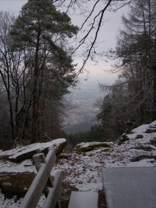
Eine trainingsrunde für den Sontagmorgen. Erst hoch zum Schloss Hambach und dan Weiter hoch zum Nollenkopf. Nur 490m aber der weg dahin geht nur rauf..... Abder danach gehts runter und wieder rauf aber dann ist es vorbei und nur noch geniesen. Nach unten geht es durch dem Kaltenbrunnertal zuruck nach Neustadt.

Tour gallery

Tour map and elevation profile

  • Open Street Map
  • Google
Minimum height 150 m Maximum height 509 m Detailed view

More about the tour author

Bedee
Member since 2008

Send private message

Comments

knocker on 26.07.2009

abwechslungsreich & knackig

Der Anfangsanstieg wird mit teilweise tollen Aussichten belohnt. Von Straße bis kleiner Waldweg ist auf der Tour alles dabei, sehr schön. Ich bin die Strecke mit einem Crossbike gefahren, das geht eigentlich auch ganz gut bis auf ein paar kurze Abschnitte.

Parken konnt ihr hier N49 20.413 E8 08.506 oder etwas weiter beim Bad N49 19.957 E8 08.067

Und wie mann in Neustadt kommt ...... an der Weinstrasse Links

GPS tracks

Trackpoints
  • GPX / Garmin Map Source (gpx) download
  • TCX / Garmin Training Center® (tcx) download
  • CRS / Garmin Training Center® (crs) download
  • Google Earth (kml) download
  • G7ToWin (g7t) download
  • TTQV (trk) download
  • Overlay (ovl) download
  • Fugawi (txt) download
  • Kompass (DAV) Track (tk) download
  • Track data sheet (pdf) download
  • Original file of the author (gpx) download

More about the tour author

Bedee
Member since 2008

Send private message
Share track
Add to my favorites
Remove from my favorites
Edit tags
My score
Rate
Track: NadW: Nollenkopf
Type: Mountain bike
Distance: 22,5 km
Evaluated on:
Duration:
Day(s)
Hour(s)
Minute(s)
Score: Landscape Fun factor Fitness Technique