


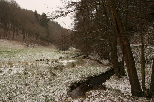
Eine kleine Tour für Gemündurlauber. Familienfreundlich geht es immer wieder über Hügel und Täler - sowohl über Felder als auch in den Wald. Teilweise fürht der Weg an der urft entlang und streift den Nationalpark Eifel.
Leider hatten wir kein so schönes Wetter, so dass keine großen Ausblicke gegeben waren. Aber die unwirkliche Landschaft und das rauhe Klima hatte auch etwas sehr Reizvolles.
Further information at
http://www.ferienpark-gemuend.deTour gallery


Tour map and elevation profile
Minimum height 339 m
Maximum height 472 m
More about the tour author
|
|
Schiller1963 |
Comments

Parkplatz am Ferienpark Schleiden-Gemünd, Haselnussweg
GPS tracks
Trackpoints-
GPX / Garmin Map Source (gpx) download
-
TCX / Garmin Training Center® (tcx) download
-
CRS / Garmin Training Center® (crs) download
-
Google Earth (kml) download
-
G7ToWin (g7t) download
-
TTQV (trk) download
-
Overlay (ovl) download
-
Fugawi (txt) download
-
Kompass (DAV) Track (tk) download
-
Track data sheet (pdf) download
-
Original file of the author (gpx) download
More about the tour author
|
|
Schiller1963 |
Add to my favorites
Remove from my favorites
Edit tags
Open track
My score
Rate