Login

Forgot your login?

Cookies have to be accepted!
Your browser's cookie functionality is disabled. Please enable this functionality.

Not a member yet?

Register now
Login

Available for registred users only

Log in to use this feature.

Forgot your login?

Cookies have to be accepted!
Your browser's cookie functionality is disabled. Please enable this functionality.

Not a member yet?

Register now
Filter
Categories
Advanced filters
  • Distance (km)
  • Height
Save filters Reset filter

TrackRank

QRCode

Technical data

Distance28,1 km Height164 m Way down134 m Duration02:00 h:m Date17.01.2009
Scores Author Landscape Fun factor Fitness Technique

Statistics

210 Views 1 Score 24 Downloads 5.00 Average
Rate
  • Track data sheet
  • Directions
  • Downloads

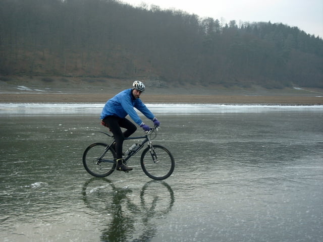
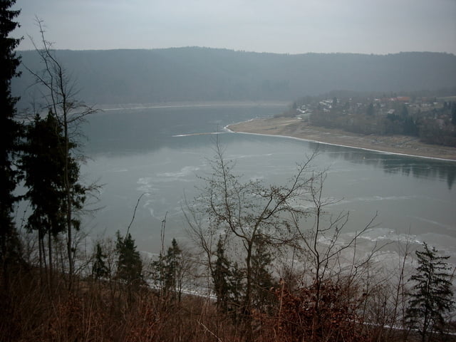
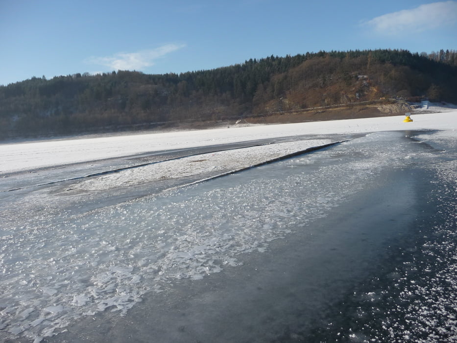
Nur alle paar Jahre ist der Edersee so zugefroren, dass er zum Spielplatz für viele Sportarten wird.

Ausgerüstet mit Spikereifen und einer ausreichenden Portion Vorsicht ein besonderes Erlebnis.

Tour gallery

Tour map and elevation profile

  • Open Street Map
  • Google
Minimum height 221 m Maximum height 330 m Detailed view

More about the tour author

muelleru
Member since 2008

Send private message

Comments

spike on 22.11.2009

Toll

Werde die Tour gleich nachfahren.
Super Idee diese hier zu Posten.
Greezy

GPS tracks

Trackpoints
  • GPX / Garmin Map Source (gpx) download
  • TCX / Garmin Training Center® (tcx) download
  • CRS / Garmin Training Center® (crs) download
  • Google Earth (kml) download
  • G7ToWin (g7t) download
  • TTQV (trk) download
  • Overlay (ovl) download
  • Fugawi (txt) download
  • Kompass (DAV) Track (tk) download
  • Track data sheet (pdf) download
  • Original file of the author (gpx) download

More about the tour author

muelleru
Member since 2008

Send private message
Share track
Add to my favorites
Remove from my favorites
Edit tags
My score
Rate
Track: Tour auf dem (Eis) Edersee
Type: Mountain bike
Distance: 28,1 km
Evaluated on:
Duration:
Day(s)
Hour(s)
Minute(s)
Score: Landscape Fun factor Fitness Technique