


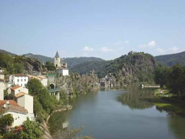
Super Trekkingbiketour mit Start in Montmarault, nördlich des Massiv Central in Mittelfrankreich. Die 9 tägige Tour führt über die einsame, dünn besiedelte Hochebene des Massiv Central gegen Süden. In Millau besichtigte ich das imposante Bauwerk der gigantischen Autobahnbrücke über das Val de Tarn. Ich folge dem traumhaft schönen Tarntal bis Ambialet. Nun drehe ich wieder nach Süden ab und umfahre Toulouse östlich. In dieser Gegend muss mit relativ starkem Gegenwind gerechnet werden. Ab St.Girons spürt man den Wind weniger, wir befinden uns im Massiv Central. Diverse Pyrenäenpässe überquerend fahre ich der spanischen Grenze nach westwärts. Diese Gegend ist landschaftlich nicht zu überbieten. Diverse Bilder haben sich unauslöschlich in mein Hirn eingebrannt. Die Menschen in den abgelegenen Gegenden schätzen es sehr, wenn man mit ihnen Kontakt aufnimmt. Die Tour endet in St. Fort/s Gironde 60 km westlich von Bordeaux und 30 km östlich von Royan, nördlich der Gironde.
Vollständikeitshalber führe ich hier die überfahren Pässe auf:
Col des Goules, Col de Ceyssat, Col de la Moréno, Col de la Malmuoche, Col de Bonnescombe, Col de Portet d'Aspet, Col de Menté, Col de Peyresourde, Col d'Aspin, Col du Tourmalet, Col de Soulor, Col de Marie-Blanque, Col Ichère, Col de Lie.
Tour gallery
Tour map and elevation profile
Minimum height -13 m
Maximum height 2118 m
More about the tour author
|
|
Tourer |
Comments

Start in Montmarault in Mittelfrankreich nördlich vom Massiv Central
GPS tracks
Trackpoints-
GPX / Garmin Map Source (gpx) download
-
TCX / Garmin Training Center® (tcx) download
-
CRS / Garmin Training Center® (crs) download
-
Google Earth (kml) download
-
G7ToWin (g7t) download
-
TTQV (trk) download
-
Overlay (ovl) download
-
Fugawi (txt) download
-
Kompass (DAV) Track (tk) download
-
Track data sheet (pdf) download
More about the tour author
|
|
Tourer |
Add to my favorites
Remove from my favorites
Edit tags
Open track
My score
Rate