Die Tour führt am Anfang ein kurzes Stück durch Gelnhausen, geht dann aber schnell in den Wald über. Ab und zu muss man vom Fahrrad absteigen, da man ein Gatter öffnen muss.
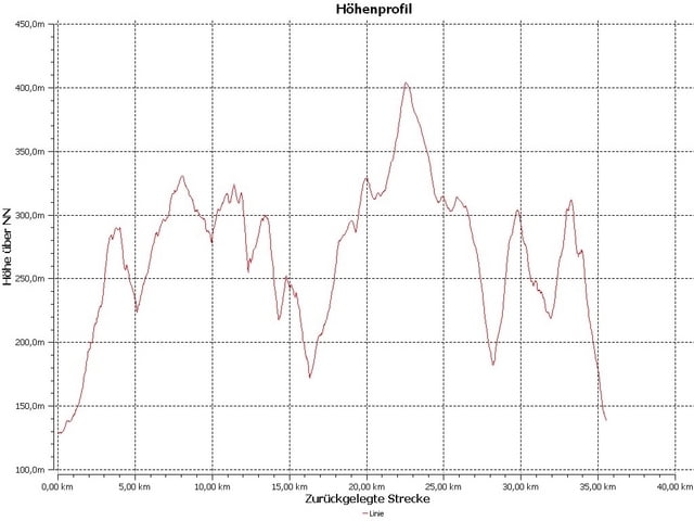
Die Steigungen wechseln sich gut mit Abfahrten ab. Zum Schluss kann es auch schon einmal etwas happig werden.
Kurz nach dem Funkturm kommt eine etwas problematischere Abfahrt. Ansonsten sind alle Untergründe Schotter und Mulch.
Der letzte Wegpunkt ist nicht am Anfangspunkt, man sollte aber von dort einfach wieder zu diesem zurück finden.
Eine Bitte:
Wenn ihr euch die Tour runterladet und abfahrt, gebt dann bitte mal eine Bewertung ab, dass dient dann auch meiner Einschätzung.
Tour map and elevation profile
Comments

Über die A66, runter an der Abfahrt Gelnhausen-West.
Dann in die Stadt Gelnhausen rein, bis auf der rechten Seite ein Parkplatz (das ist der Parkplatz des Gelnhäuser Hallenbades) auftaucht. Das ist der Startpunkt.
GPS tracks
Trackpoints-
GPX / Garmin Map Source (gpx) download
-
TCX / Garmin Training Center® (tcx) download
-
CRS / Garmin Training Center® (crs) download
-
Google Earth (kml) download
-
G7ToWin (g7t) download
-
TTQV (trk) download
-
Overlay (ovl) download
-
Fugawi (txt) download
-
Kompass (DAV) Track (tk) download
-
Track data sheet (pdf) download
-
Original file of the author (gpx) download


