Login

Forgot your login?

Cookies have to be accepted!
Your browser's cookie functionality is disabled. Please enable this functionality.

Not a member yet?

Register now
Login

Available for registred users only

Log in to use this feature.

Forgot your login?

Cookies have to be accepted!
Your browser's cookie functionality is disabled. Please enable this functionality.

Not a member yet?

Register now
Filter
Categories
Advanced filters
  • Distance (km)
  • Height
Save filters Reset filter

TrackRank

QRCode

Technical data

Distance21,3 km Height2692 m Way down202 m Duration10 days 0 h Date17.02.2009
Scores Author Landscape Fun factor Fitness Technique

Statistics

1045 Views Scores 116 Downloads Average
Rate
  • Track data sheet
  • Directions
  • Downloads

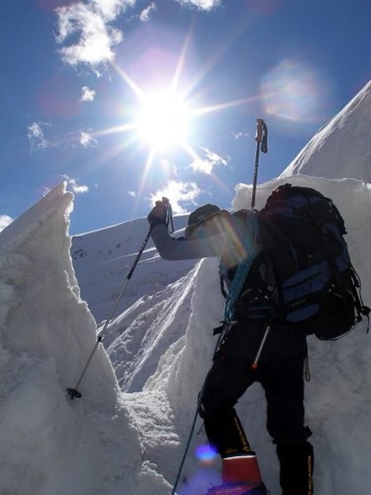
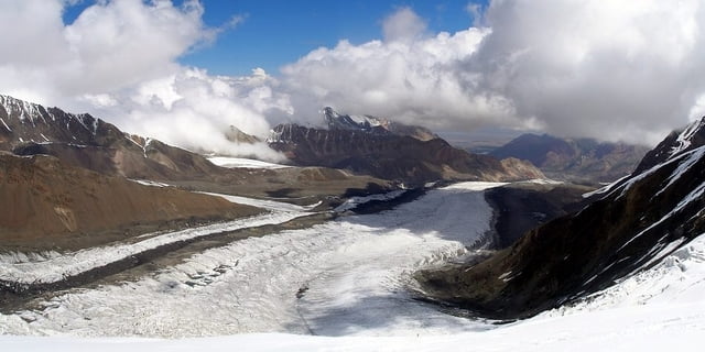
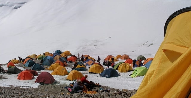
Výstup z ABC Luková Poljana do 3 výškového tábora po cestě na Pik Lenina.

3 výškový tábor je pod vrcholem Piku Razdělnaja. 6 123m n m

Na vrchol Piku Lenina se nepodařilo vystoupit.

Further information at

http://www.horskesporty.cz/view.php?nazevclanku=pamir-2008-pik-lenina&cisloclanku=2008081801

Tour gallery

Tour map and elevation profile

  • Open Street Map
  • Google
Minimum height 3574 m Maximum height 6123 m Detailed view

More about the tour author

Aldo
Member since 2008

Send private message

Comments

GPS tracks

Trackpoints
  • GPX / Garmin Map Source (gpx) download
  • TCX / Garmin Training Center® (tcx) download
  • CRS / Garmin Training Center® (crs) download
  • Google Earth (kml) download
  • G7ToWin (g7t) download
  • TTQV (trk) download
  • Overlay (ovl) download
  • Fugawi (txt) download
  • Kompass (DAV) Track (tk) download
  • Track data sheet (pdf) download
  • Original file of the author (gpx) download

More about the tour author

Aldo
Member since 2008

Send private message
Share track
Add to my favorites
Remove from my favorites
Edit tags
My score
Rate
Track: Pik Lenina - Pik Razdělnaja
Type: Mountain hiking
Distance: 21,3 km
Evaluated on:
Duration:
Day(s)
Hour(s)
Minute(s)
Score: Landscape Fun factor Fitness Technique