


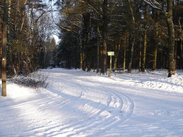
Von Norderstedt aus geht es vor bei am Rantzauer Forst über Winzeldorf und Wulfsmühle zum Himmelmoor bei Quickborn. Vom Himmelmoor geht es an Quickborn vorbei ins Holmmoor und dann zurück nach Norderstedt durch den Rantzauer Forst.
Tour gallery
Tour map and elevation profile
Minimum height 5 m
Maximum height 34 m
More about the tour author

|
s-hh |
Comments
U-Bahn (U1) bis Norderstedt Mitte. Los geht es in der Nähe der Moorbek-Passage.
GPS tracks
Trackpoints-
GPX / Garmin Map Source (gpx) download
-
TCX / Garmin Training Center® (tcx) download
-
CRS / Garmin Training Center® (crs) download
-
Google Earth (kml) download
-
G7ToWin (g7t) download
-
TTQV (trk) download
-
Overlay (ovl) download
-
Fugawi (txt) download
-
Kompass (DAV) Track (tk) download
-
Track data sheet (pdf) download
-
Original file of the author (gpx) download
More about the tour author
|
|
s-hh |
Add to my favorites
Remove from my favorites
Edit tags
Open track
My score
Rate
Sonst eine technisch einfache Tour, mit 50% Asphalt, 40% Forstautobahnen und 10% Trails (gefühlt).
Als schnelle Trainingsrunde am Abend gut geeignet. Auch als Dunkeltour gut zu fahren.
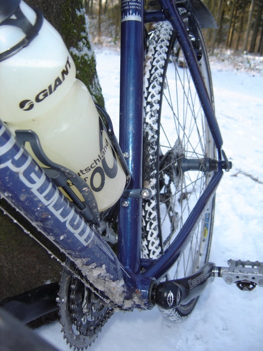
Auch mit dem Trekkingrad oder Crosser gut zu fahren.