Login

Forgot your login?

Cookies have to be accepted!
Your browser's cookie functionality is disabled. Please enable this functionality.

Not a member yet?

Register now
Login

Available for registred users only

Log in to use this feature.

Forgot your login?

Cookies have to be accepted!
Your browser's cookie functionality is disabled. Please enable this functionality.

Not a member yet?

Register now
Filter
Categories
Advanced filters
  • Distance (km)
  • Height
Save filters Reset filter

TrackRank

QRCode

Technical data

Distance5,0 km Height259 m Way down159 m Duration01:00 h:m Date22.02.2009
Scores Author Landscape Fun factor Fitness Technique

Statistics

1457 Views Scores 115 Downloads Average
Rate
  • Track data sheet
  • Directions
  • Downloads

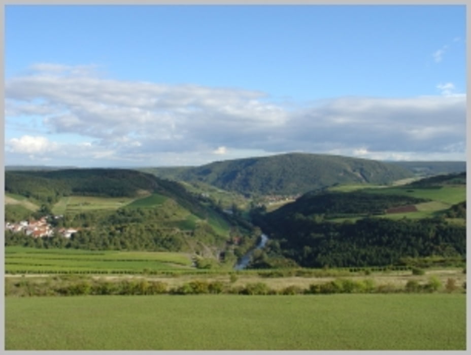
Tolle Aussicht mit einem Rundblick übers Nahetal.

Von der Aussichtsplattform bei guter Sicht vom Soonwald bis zum Taunus, Pfälzerwald und Odenwald.


Further information at

http://www.harfenmuehle.net

Tour gallery

Tour map and elevation profile

  • Open Street Map
  • Google
Minimum height 52 m Maximum height 313 m Detailed view

More about the tour author

Plunschbauch
Member since 2008

Send private message

Comments

Von Waldböckelheim den Hinweisschildern folgen

Start: vom Friedhof Schlossböckelheim

GPS tracks

Trackpoints
  • GPX / Garmin Map Source (gpx) download
  • TCX / Garmin Training Center® (tcx) download
  • CRS / Garmin Training Center® (crs) download
  • Google Earth (kml) download
  • G7ToWin (g7t) download
  • TTQV (trk) download
  • Overlay (ovl) download
  • Fugawi (txt) download
  • Kompass (DAV) Track (tk) download
  • Track data sheet (pdf) download
  • Original file of the author (gpx) download

More about the tour author

Plunschbauch
Member since 2008

Send private message
Share track
Add to my favorites
Remove from my favorites
Edit tags
My score
Rate
Track: Heimberg Aussichtsturm an der Nahe
Type: Hiking
Distance: 5,0 km
Evaluated on:
Duration:
Day(s)
Hour(s)
Minute(s)
Score: Landscape Fun factor Fitness Technique