


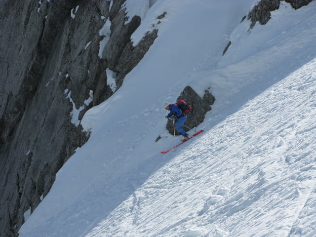
Vom Wanderparkplatz bei Griessenbach geht as auf einer Forststraße der Beschilderung folgend bis zur Eppzirler Alm. Je nach Schneelage und Jahreszeit kann hierher auch mit dem MTB gefahren werden. Von der Eppzirler Alm geht man weiter in den Talkessel. Eine erste kleine Steilstufe gilt es zu überwinden. Oben angekommen kann man sich immer noch entscheiden die niedrigere Eppzirler Scharte zu besteigen. Wer zur Kuhlochscharte will, muss isch nun rechts halten und über mittelsteiles Skigelände ansteigen bis er wieder eine kurze Verschnaufpause erhält. Die letzten Meter zur Kuhlochscharte sind dann noch einmal steiler. Die Abfahrt folgt der Aufstiegspur
Tour gallery


Tour map and elevation profile
Minimum height 1025 m
Maximum height 2187 m
More about the tour author

|
killerpellet |
Comments

Von Scharnitz kommend fährt man auf der Bundesstraße in Richtung Seefeld. Der erste Ort nach Scharnitz ist Griessenbach. In Griessenbach die erste Möglichkeit links hinein und über die Bahngleise zum Wanderparkplatz.
GPS tracks
Trackpoints-
GPX / Garmin Map Source (gpx) download
-
TCX / Garmin Training Center® (tcx) download
-
CRS / Garmin Training Center® (crs) download
-
Google Earth (kml) download
-
G7ToWin (g7t) download
-
TTQV (trk) download
-
Overlay (ovl) download
-
Fugawi (txt) download
-
Kompass (DAV) Track (tk) download
-
Track data sheet (pdf) download
-
Original file of the author (gpx) download
More about the tour author
|
|
killerpellet |
Add to my favorites
Remove from my favorites
Edit tags
Open track
My score
Rate