


Der Colativi ist der höchste Gipfel der Sierra de Alhamilla
Start der Piste auf den Collativi ist am Friedhof von Huebro. Die ersten 10km sind sandig, danach ist asphaltiert. Der aufgezeichnete Track führt den gleichen Weg zurück. Vom Berggipfel sind viele Alternativrouten auf Pisten zu erkennen, die jedoch in keiner aktuellen Karte (Almeria L 1045, 2001) eingezeichnet sind.
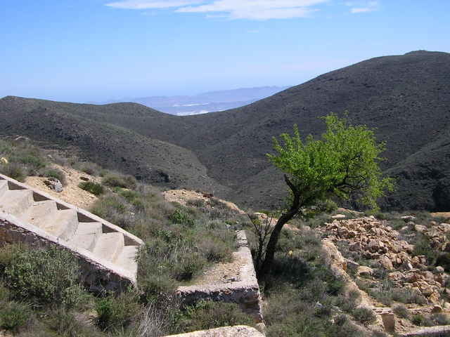
Der Abstecher zur Mina Laiquiez lohnt, man könnte auch zur Verladestation der Mine ca. 100m unterhalb fahren, und von dort aus versuchen, über die Collade de la Fuente nach Huebro zu fahren.
Unbedingt sehenswert: das Tal von Huebro nach Nijar mit seinem Bewässerungssystem. Es gibt hier auch einen befahrbaren Wanderweg bergab.
Start der Piste auf den Collativi ist am Friedhof von Huebro. Die ersten 10km sind sandig, danach ist asphaltiert. Der aufgezeichnete Track führt den gleichen Weg zurück. Vom Berggipfel sind viele Alternativrouten auf Pisten zu erkennen, die jedoch in keiner aktuellen Karte (Almeria L 1045, 2001) eingezeichnet sind.
Der Abstecher zur Mina Laiquiez lohnt, man könnte auch zur Verladestation der Mine ca. 100m unterhalb fahren, und von dort aus versuchen, über die Collade de la Fuente nach Huebro zu fahren.
Unbedingt sehenswert: das Tal von Huebro nach Nijar mit seinem Bewässerungssystem. Es gibt hier auch einen befahrbaren Wanderweg bergab.
Tour gallery
Tour map and elevation profile
Minimum height 682 m
Maximum height 1364 m
More about the tour author
|
|
komamati-san |
Comments

GPS tracks
Trackpoints-
GPX / Garmin Map Source (gpx) download
-
TCX / Garmin Training Center® (tcx) download
-
CRS / Garmin Training Center® (crs) download
-
Google Earth (kml) download
-
G7ToWin (g7t) download
-
TTQV (trk) download
-
Overlay (ovl) download
-
Fugawi (txt) download
-
Kompass (DAV) Track (tk) download
-
Track data sheet (pdf) download
-
Original file of the author (g7t) download
More about the tour author
|
|
komamati-san |
Add to my favorites
Remove from my favorites
Edit tags
Open track
My score
Rate