


Santa Lucia XL
Samstag, 8:00 - 16:00 Uhr, reine Fahrzeit ca. 6h
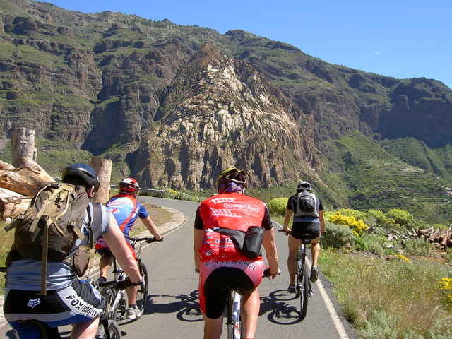
Level 3, 80 km, 1800 hm auf, 1800 hmAnspruchsvolle Auffahrt - 1300 Höhenmeter im Tal der „Tausend Palmen“ - sagenhafte Grand Canyon Blicke - ab Risco Blanco weiter mit St. Lucia Level 2 - nur für konditionsstarke Biker!
Samstag, 8:00 - 16:00 Uhr, reine Fahrzeit ca. 6h
Level 3, 80 km, 1800 hm auf, 1800 hmAnspruchsvolle Auffahrt - 1300 Höhenmeter im Tal der „Tausend Palmen“ - sagenhafte Grand Canyon Blicke - ab Risco Blanco weiter mit St. Lucia Level 2 - nur für konditionsstarke Biker!
Further information at
http://www.free-motion.net/fm/de/tours.phpTour gallery
Tour map and elevation profile
Minimum height 8 m
Maximum height 1142 m
More about the tour author

|
winklem |
Comments
Start am Free Motion Center in der Avda. de Alfereces Provisionales
GPS tracks
Trackpoints-
GPX / Garmin Map Source (gpx) download
-
TCX / Garmin Training Center® (tcx) download
-
CRS / Garmin Training Center® (crs) download
-
Google Earth (kml) download
-
G7ToWin (g7t) download
-
TTQV (trk) download
-
Overlay (ovl) download
-
Fugawi (txt) download
-
Kompass (DAV) Track (tk) download
-
Track data sheet (pdf) download
-
Original file of the author (g7t) download
More about the tour author
|
|
winklem |
Add to my favorites
Remove from my favorites
Edit tags
Open track
My score
Rate
So lala
Feedback
vielen Dank für die prima Tour, habe diese am 10.12.2013 genossen. Klar der "off road- Anteil" hält sich etwas in Grenzen. Aber wie Du schreibst, die Aussichten bei Risco Blanko sind gigantisch und entschädigen. Ralf, Deine u.a. Vermutung ist richtig. Die Landschaft und die Aussichten in der Region beim weißen Fels sind die High Lights der Tour.
Besten Dank nochmals, schöne Grüße, Erwin