


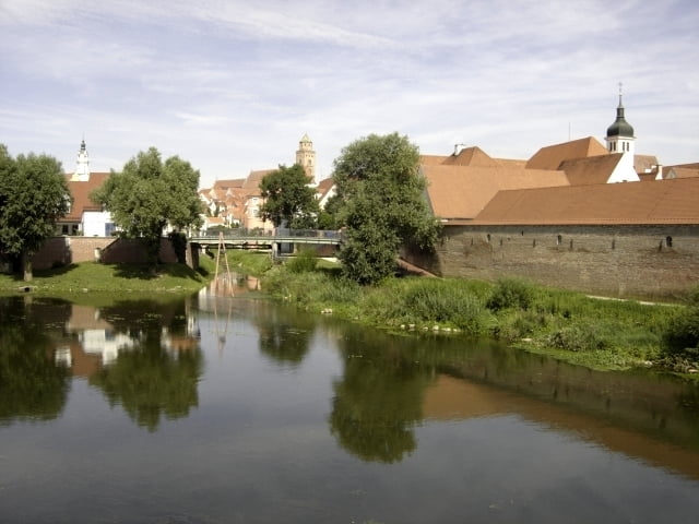
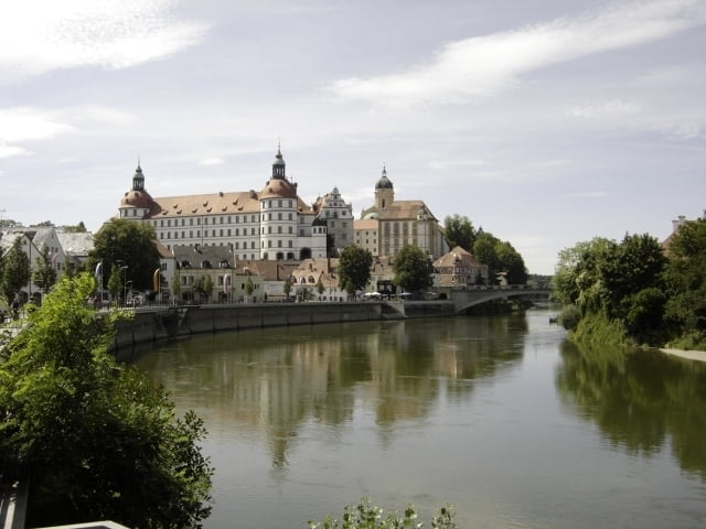
Die dritte Etappe führt von Ulm über Günzburg, Dillingen, Donauwörth und Neuburg nach Ingolstadt.
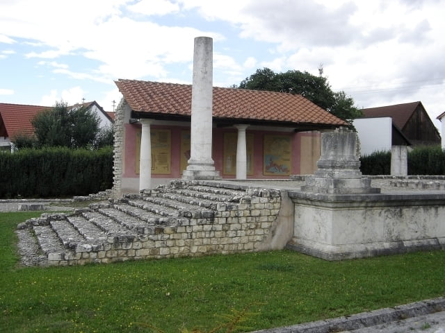
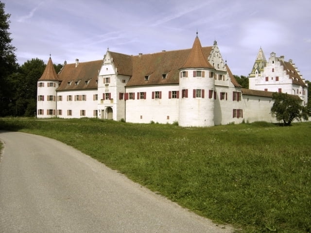
Neben zahlreichen Schlössern entlang der Strecke befindet sich kurz vor Lauingen im Ort Faimingen ein Römertempel. Nach dem Ort Gremheim (hinter der Brücke rechts) kann man rasten und eine Natur-Kneippanlage nutzen, bevor es weiter durchs Donau-Ries geht. Kurz vor Donauwörth verläuft der Zusamradweg von Kaufbeuren kommend parallel zum Donauradweg.
Teilstrecken:
- Ulm-Guenzburg 29,0 km
- Guenzburg-Dillingen 27,9 km
- Dillingen-Donauwörth 36,9 km
- Donauwörth-Neuburg 36,4 km
- Neuburg-Ingolstadt 23,5 km
Weitere Radwege:
- Zweite Etappe des Donauradweges: Sigmaringen-Ulm
- Vierte Etappe des Donauradweges: Ingolstadt-Regensburg
- Zusamradweg: Kaufbeuren-Donauwörth
- Illerradweg: Oberstdorf-Ulm
- Landrat Dr.-Frey- und Donauried-Radweg: Augsburg-Dillingen
Further information at
http://www.donau-radweg.info/Tour gallery
Tour map and elevation profile
Minimum height 366 m
Maximum height 482 m
More about the tour author
|
|
Alu68 |
Comments

Die bayrischen Städte entlang der Donau: Günzburg, Lauingen, Dillingen, Donauwörth, Neuburg, Weichering, Ingolstadt, Neustadt, Saal, Regensburg und Straubing sind zwischen Ulm und Passau mit Regionalzügen erreichbar.
Am Vormittag fährt ein Fahrradzug mit mehr Fahrradstellplätzen von Ulm nach Passau und am Nachmittag zurück.
GPS tracks
Trackpoints-
GPX / Garmin Map Source (gpx) download
-
TCX / Garmin Training Center® (tcx) download
-
CRS / Garmin Training Center® (crs) download
-
Google Earth (kml) download
-
G7ToWin (g7t) download
-
TTQV (trk) download
-
Overlay (ovl) download
-
Fugawi (txt) download
-
Kompass (DAV) Track (tk) download
-
Track data sheet (pdf) download
-
Original file of the author (gpx) download
More about the tour author
|
|
Alu68 |
Add to my favorites
Remove from my favorites
Edit tags
Open track
My score
Rate