


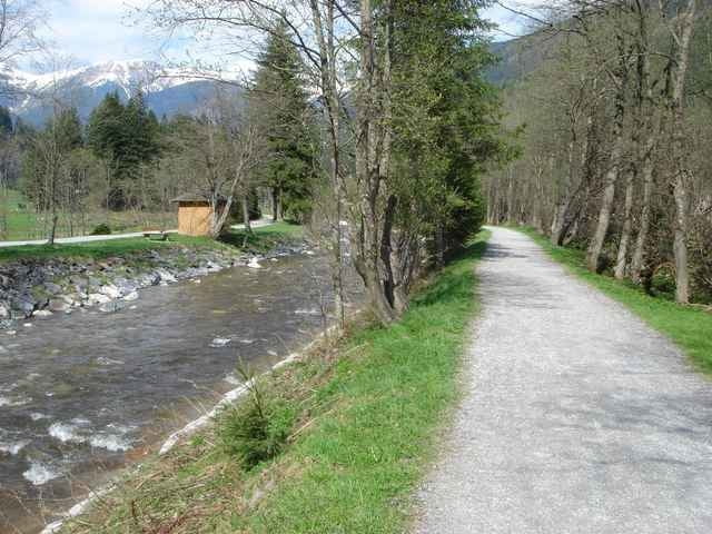
03.05.06 – Die gemütliche Runde beginnt am Chalet Wetzlgut oberhalb des Bahnhofs von Bad Gastein. Von dort durch den Ort zum etwas höher gelegenen Bauhof und weiter nach Böckstein. Zurück geht’s auf der Kaiserin Elisabeth Promenade direkt neben der Gasteiner Ache. Wer das ganze etwas flotter und als Training nutzen will, der schnappt sich wie ich dazu ein Mountainbike und strampelt auf gleicher strecke sechs runden flott herunter!
Further information at
http://www.gastein.comTour gallery
Tour map and elevation profile
Minimum height 1060 m
Maximum height 1131 m
More about the tour author
|
|
exitus |
Comments

Autobahn A10 (von Salzburg oder Villach kommend) abfahrt Bischofshofen, weiter auf der B311 bis kurz vor Lend - abbiegen auf die B167 nach Bad Gastein (Plz 5640).
GPS tracks
Trackpoints-
GPX / Garmin Map Source (gpx) download
-
TCX / Garmin Training Center® (tcx) download
-
CRS / Garmin Training Center® (crs) download
-
Google Earth (kml) download
-
G7ToWin (g7t) download
-
TTQV (trk) download
-
Overlay (ovl) download
-
Fugawi (txt) download
-
Kompass (DAV) Track (tk) download
-
Track data sheet (pdf) download
-
Original file of the author (gpx) download
More about the tour author
|
|
exitus |
Add to my favorites
Remove from my favorites
Edit tags
Open track
My score
Rate