Login

Forgot your login?

Cookies have to be accepted!
Your browser's cookie functionality is disabled. Please enable this functionality.

Not a member yet?

Register now
Login

Available for registred users only

Log in to use this feature.

Forgot your login?

Cookies have to be accepted!
Your browser's cookie functionality is disabled. Please enable this functionality.

Not a member yet?

Register now
Filter
Categories
Advanced filters
  • Distance (km)
  • Height
Save filters Reset filter

TrackRank

QRCode

Technical data

Distance30,7 km Height805 m Way down811 m Duration02:15 h:m Date17.05.2009
Scores Author Landscape Fun factor Fitness Technique

Statistics

989 Views 2 Scores 289 Downloads 2.50 Average
Rate
  • Track data sheet
  • Directions
  • Downloads

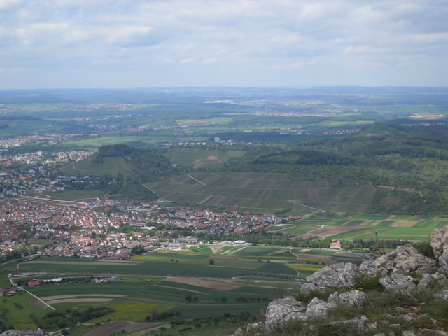
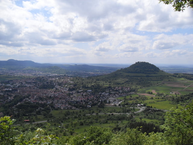
Landschaftlich sehr schöne Trainingsrunde rund ums Rossfeld bei Bad Urach.

Tour gallery

Tour map and elevation profile

  • Open Street Map
  • Google
Minimum height 413 m Maximum height 827 m Detailed view

More about the tour author

dschurna
Member since 2008

Send private message

Comments

Guest on 24.05.2009

MB Tour 24.05.09

Habe die Tour gekürzt (Start von Glems aus Richtung Gutenberg) ohne den Teil ab Hohe Warte bis Dettinger Höllenlöcher (20km, 1:45h). Dafür von Gutenberg immer am Albdrauf entlang über Grüner Fels, Höllenlöcher, Segelflugplatz bis zum Olgafels. Super schöne Eindrücke u. heute war prima Fernsicht über Pfullingen, Achalm, Metzingen.
enforce on 06.07.2014

ganz nett

Kondition ""
Technik "
sonst für GA ganz OK
Bei Metzingen ins Ermstal Richtung Ulm/Bad Urach auf die B28. Ausfahrt Dettingen Ost, dann nach 500 m Parkplatz recht bei Papierfabrik Arjo Wiggens

GPS tracks

Trackpoints
  • GPX / Garmin Map Source (gpx) download
  • TCX / Garmin Training Center® (tcx) download
  • CRS / Garmin Training Center® (crs) download
  • Google Earth (kml) download
  • G7ToWin (g7t) download
  • TTQV (trk) download
  • Overlay (ovl) download
  • Fugawi (txt) download
  • Kompass (DAV) Track (tk) download
  • Track data sheet (pdf) download
  • Original file of the author (gpx) download

More about the tour author

dschurna
Member since 2008

Send private message
Share track
Add to my favorites
Remove from my favorites
Edit tags
My score
Rate
Track: Rossfeld
Type: Mountain bike
Distance: 30,7 km
Evaluated on:
Duration:
Day(s)
Hour(s)
Minute(s)
Score: Landscape Fun factor Fitness Technique