


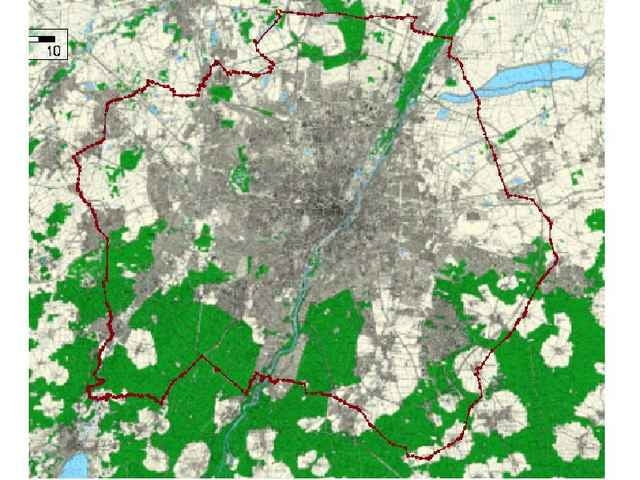
Erste Version meiner Münchenumrundung. Als Eckpunkte wurden vorzugsweise Biergärten gewählt, natürlich nur zum Wassernachfüllen ;-)
Start in Karlsfeld, durchgehend asphaltierte Strecke. Für den sportlichen Radler mit 124km eine ausfüllende Sonntagnachmittags-Trainingsrunde.(update: 20.07.06)
Start in Karlsfeld, durchgehend asphaltierte Strecke. Für den sportlichen Radler mit 124km eine ausfüllende Sonntagnachmittags-Trainingsrunde.(update: 20.07.06)
Tour gallery
Tour map and elevation profile
Minimum height 480 m
Maximum height 646 m
More about the tour author

|
Comments
GPS tracks
Trackpoints-
GPX / Garmin Map Source (gpx) download
-
TCX / Garmin Training Center® (tcx) download
-
CRS / Garmin Training Center® (crs) download
-
Google Earth (kml) download
-
G7ToWin (g7t) download
-
TTQV (trk) download
-
Overlay (ovl) download
-
Fugawi (txt) download
-
Kompass (DAV) Track (tk) download
-
Track data sheet (pdf) download
-
Original file of the author (g7t) download
More about the tour author
|
|
Add to my favorites
Remove from my favorites
Edit tags
Open track
My score
Rate
Lob & Kritik