


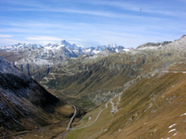
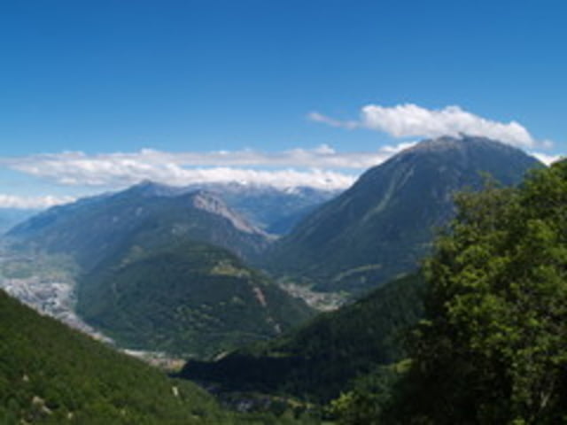
De 784km lange tocht start in Stamberg, nabij München. Na een korte 'aanloop' in zuidelijke richting, krijgt men toegang tot de Alpen. Vervolgens worden de Alpen doorkruist, waarbij de volgende vijf landen worden aangedaan: Duitsland - Oostenrijk - Italië - Zwitserland - Frankrijk. De tocht eindigt in Albertville.
Tour gallery


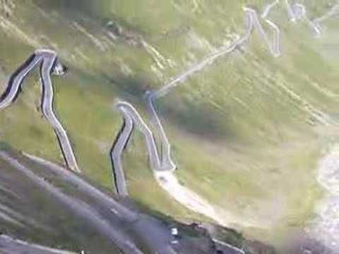
Tour map and elevation profile
Minimum height 347 m
Maximum height 2763 m
More about the tour author
|
|
-guy- |
Comments

Stamberg - Penzberg - Kochel am See - Mittenwald - grens Duitsland-Oostenrijk - Telfs - Prutz - Pfunds - Nauders - grens Oostenrijk-Italië - Curon Venosta - Malles Venosta - Parco Nationale dello Stelvio - Valdidentro - Livigno - grens Italië-Zwitserland - Zernez - La Punt-Chamues-ch - Bergün - Filisur - Surava - Thusis - Bonaduz - Castrisch - Obersaxen - Disentir/Mustér - Tavetsch - Andermatt - Fiesch - Brig-Glis - Sieree - Sion - Saxon - Martigny - grens Zwitserland-Frankrijk - Chamonix-Mont-Blanc - Mégève - Albertville
GPS tracks
Trackpoints-
GPX / Garmin Map Source (gpx) download
-
TCX / Garmin Training Center® (tcx) download
-
CRS / Garmin Training Center® (crs) download
-
Google Earth (kml) download
-
G7ToWin (g7t) download
-
TTQV (trk) download
-
Overlay (ovl) download
-
Fugawi (txt) download
-
Kompass (DAV) Track (tk) download
-
Track data sheet (pdf) download
-
Original file of the author (gpx) download
More about the tour author
|
|
-guy- |
Add to my favorites
Remove from my favorites
Edit tags
Open track
My score
Rate