
")

Die Tour startet in Pinneberg am dortigen Bahnhof.
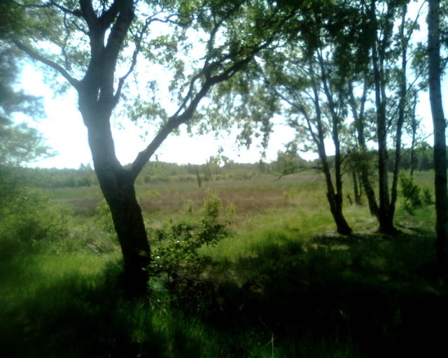
Zunächst geht es ein recht kurzes Stück über Straßen und befestigte Feldwege in Richtung Klövensteen. Der Forst Klövensteen wird nur kurz durchquert bis man ins Buttermoor gerät.
Von da aus führt die Route ausschließlich durchs Grün zu den Holmer Sandbergen.
Weiter geht es in Richtung Wedel, noch einmal den Mühlenteich umrundet, bis zur S-Bahn.
Hier bietet es sich evbtl. an noch weiter zur Elbe zu fahren - mir fehlte leider die Zeit!
Pinneberg - Buttermoor - Holmer Sandberge - Wedel
Further information at
http://www.hvv.deTour gallery
Tour map and elevation profile
Minimum height -33 m
Maximum height 54 m
More about the tour author
|
|
Folki |
Comments

S-Bahn Pinneberg ist Start, S-Bahn Wedel das Ziel
GPS tracks
Trackpoints-
GPX / Garmin Map Source (gpx) download
-
TCX / Garmin Training Center® (tcx) download
-
CRS / Garmin Training Center® (crs) download
-
Google Earth (kml) download
-
G7ToWin (g7t) download
-
TTQV (trk) download
-
Overlay (ovl) download
-
Fugawi (txt) download
-
Kompass (DAV) Track (tk) download
-
Track data sheet (pdf) download
-
Original file of the author (gpx) download
More about the tour author
|
|
Folki |
Add to my favorites
Remove from my favorites
Edit tags
Open track
My score
Rate