


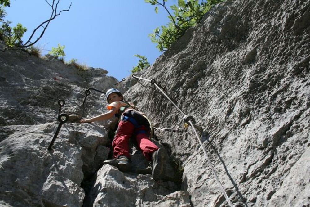
In wenigen Minuten zum Einstieg und dann einmal eingeklinkt bis oben immer die Möglichkeit eingeklinkt zu bleiben. Nett und geeignet für Kinder oder zum Beginnen.
Die Orientierung ist einfach (immer dem Seil nach).
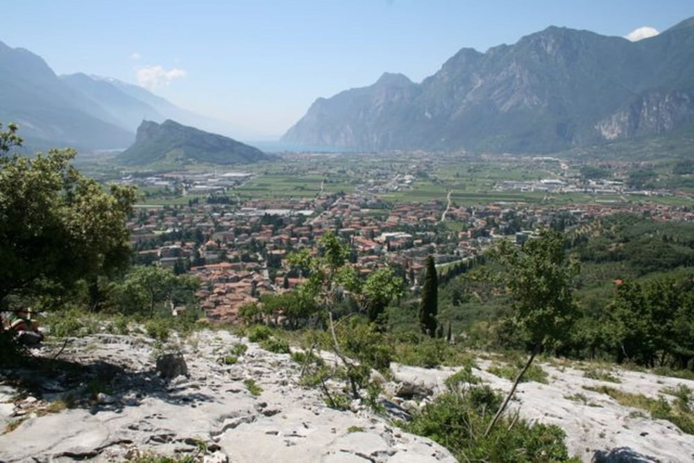
Am Ende des Steigs ein fantastischer Blick auf den Gardasee, den Monte Brione und Riva.
Im Sommer durch die Ostseitige Lage oft sehr heiss - Getränke! - Sonnenschutz!
Das Eis am Hauptplatz in Arco rundet den Genuss ab.
Further information at
http://family-dav-og-bw.de/Colodri.htmTour gallery


Tour map and elevation profile
Minimum height 100 m
Maximum height 377 m
More about the tour author

|
pecka02 |
Comments

in Arco Richtung Zeltplatz und Schwimmbad (gleich nach der Brücke über die Sarca rechts von Osten kommend). Am Schwimmbad sind Parkmöglichkeiten.
GPS tracks
Trackpoints-
GPX / Garmin Map Source (gpx) download
-
TCX / Garmin Training Center® (tcx) download
-
CRS / Garmin Training Center® (crs) download
-
Google Earth (kml) download
-
G7ToWin (g7t) download
-
TTQV (trk) download
-
Overlay (ovl) download
-
Fugawi (txt) download
-
Kompass (DAV) Track (tk) download
-
Track data sheet (pdf) download
-
Original file of the author (gpx) download
More about the tour author
|
|
pecka02 |
Add to my favorites
Remove from my favorites
Edit tags
Open track
My score
Rate