Login

Forgot your login?

Cookies have to be accepted!
Your browser's cookie functionality is disabled. Please enable this functionality.

Not a member yet?

Register now
Login

Available for registred users only

Log in to use this feature.

Forgot your login?

Cookies have to be accepted!
Your browser's cookie functionality is disabled. Please enable this functionality.

Not a member yet?

Register now
Filter
Categories
Advanced filters
  • Distance (km)
  • Height
Save filters Reset filter

TrackRank

QRCode

Technical data

Distance6,7 km Height380 m Way down1241 m Duration03:00 h:m Date14.06.2009
Scores Author Landscape Fun factor Fitness Technique

Statistics

7061 Views 1 Score 272 Downloads 5.00 Average
Rate
  • Track data sheet
  • Directions
  • Downloads

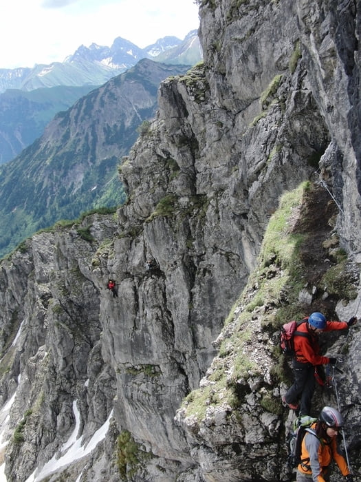
mit Kanzelwandbahn in Riezlern hoch

ca. 45min Fußweg zum Einstieg

Einstieg über Schneefeld

2h Steig bis zum Gipfel

15min Fußweg zur Bahn

Talfahr mit Kanzelwandbahn
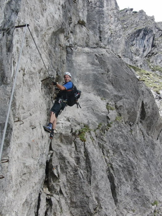
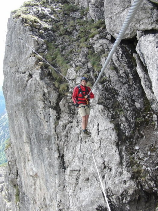
 

Tour gallery

Tour map and elevation profile

  • Open Street Map
  • Google
Minimum height 1073 m Maximum height 2055 m Detailed view

More about the tour author

asso
Member since 2008

Send private message

Comments

GPS tracks

Trackpoints
  • GPX / Garmin Map Source (gpx) download
  • TCX / Garmin Training Center® (tcx) download
  • CRS / Garmin Training Center® (crs) download
  • Google Earth (kml) download
  • G7ToWin (g7t) download
  • TTQV (trk) download
  • Overlay (ovl) download
  • Fugawi (txt) download
  • Kompass (DAV) Track (tk) download
  • Track data sheet (pdf) download
  • Original file of the author (gpx) download

More about the tour author

asso
Member since 2008

Send private message
Share track
Add to my favorites
Remove from my favorites
Edit tags
My score
Rate
Track: Zwei Länder Klettersteig Kanzelwand
Type: Via ferrata
Distance: 6,7 km
Evaluated on:
Duration:
Day(s)
Hour(s)
Minute(s)
Score: Landscape Fun factor Fitness Technique