


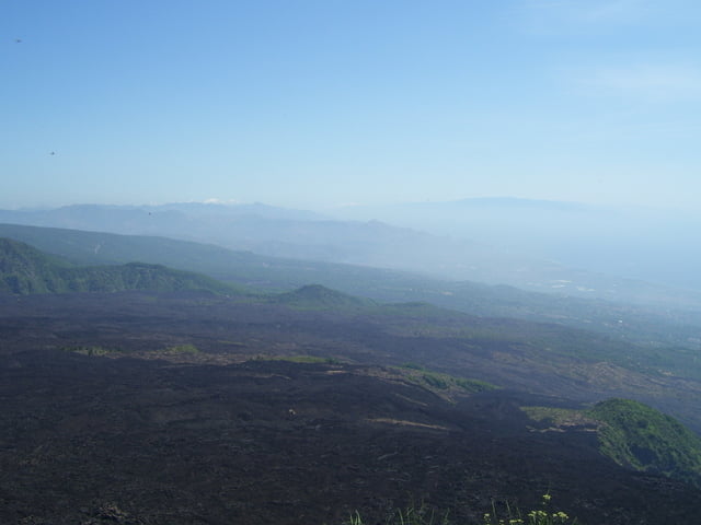
Easy hike to a mountain, from which you can see the "Valle del Bove" and sometimes watch red lava (Lava rosso). Wonderful views into the Valle del Bove.
The trek is a small, sandy footpath, sometimes steeper.
To watch red lava, walk up in the late evening, so that it's dark, when you are up.
Further information at
http://www.rainer-olzem.de/111.htmlTour gallery


Tour map and elevation profile
Minimum height 1476 m
Maximum height 1737 m
More about the tour author
|
|
hans-lauber |
Comments

From the road Zafferana Etnea to Rif. Sapienza (Etna Sud) take the road to "Cassone". There a 2 roads to Cassone, take the lower one (about 1150m), it is tared. Ignore the prohibition sign and drive 8 serpertines to the end with a parking area (1481m).
GPS tracks
Trackpoints-
GPX / Garmin Map Source (gpx) download
-
TCX / Garmin Training Center® (tcx) download
-
CRS / Garmin Training Center® (crs) download
-
Google Earth (kml) download
-
G7ToWin (g7t) download
-
TTQV (trk) download
-
Overlay (ovl) download
-
Fugawi (txt) download
-
Kompass (DAV) Track (tk) download
-
Track data sheet (pdf) download
-
Original file of the author (gpx) download
More about the tour author
|
|
hans-lauber |
Add to my favorites
Remove from my favorites
Edit tags
Open track
My score
Rate