


Etappendaten
1. Etappe: Oberstdorf - Konstanzer Hütte
- 56,6 km / 2094 hm
- Strecke: Oberstdorf (820 m) – Rappenalptal – Schrofenpass (1.687 m) – Lech – Zürs - Arlbergpass (1793m) - St. Anton - Konstanzer Hütte (1688 m)
- Übernachtung: Konstanzer Hütte
- www.konstanzerhuette.at
- 45,9km / 1635hm
- Strecke: Konstanzer Hütte (1688 m) – Heilbronner Hütte (2320m) - Zeinisjoch - Ischgl - Heidelberger Hütte (2264m)
- Übernachtung: Heidelberger Hütte
3. Etappe: Heidelberger Hütte - Laatsch
- 48,1 km / 1664 hm
- Strecke: Heidelberger Hütte - Fimberpass ( 2608 m) - Zuort - Sur En (1139 m) - Uina Dadaint - Schlinigpass (2295 m) - Sesvenna Hütte - Laatsch (987m)
- Übernachtung: Gasthof Lamm
- www.lammlaatsch.it
4. Etappe: Laatsch - St. Nikolaus
- 58,2km / 2058hm
- Strecke: Laatsch (987m) - Tarsch - Latscher Alm - Tarscher Pass ( 2527 m) - St. Moritz - St. Nikolaus (1256m)
- Übernachtung: Gasthof Mesner (nur bedingt empfehlenswert!)
5. Etappe: St. Nikolaus - Madonna di Campiglio
- 51,3 km /2270 hm
- Strecke: St. Nikolaus ( 1256m) - St. Getraud - Rabbijoch (2467m) - Haselgruber Hütte - Male -Dimaro - Madonna di Campiglio (1550m)
- Übernachtung: Hotel Vidi
www.hotelvidi.it
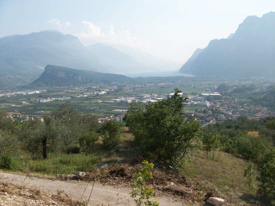
6. Etappe: Madonna di Campiglio - Riva
- 63,8 km / 1890 hm
- Strecke: Madonna di Campiglio (1550m) - Lago di Val d' Agola - Passo Bregn de l `Ors (1836m) - Stenico - Ponte Arche - San Giovanni al Monte (1100m) - Riva del Garda (66m)
- Übernachtung: Hotel Diana
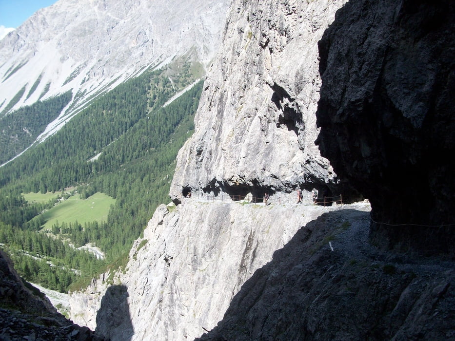
Tour gallery


Tour map and elevation profile
Minimum height 64 m
Maximum height 2623 m
More about the tour author
|
|
Staudenbiker |
Comments
GPS tracks
Trackpoints-
GPX / Garmin Map Source (gpx) download
-
TCX / Garmin Training Center® (tcx) download
-
CRS / Garmin Training Center® (crs) download
-
Google Earth (kml) download
-
G7ToWin (g7t) download
-
TTQV (trk) download
-
Overlay (ovl) download
-
Fugawi (txt) download
-
Kompass (DAV) Track (tk) download
-
Track data sheet (pdf) download
-
Original file of the author (gpx) download
More about the tour author
|
|
Staudenbiker |
Add to my favorites
Remove from my favorites
Edit tags
Open track
My score
Rate
Super Tour
Niels